
We've crossed the Cascades! But it wasn't easy by any means.
Well, let me elaborate. The first two days from Mount Vernon, Washington (Thursday June 9 and Friday June 10) were relatively easy, mostly. Thursday was spent going eastward along the Skagit River Valley. The 40 miles were mostly flat with a few hills, mostly on the east end. The landscape was pretty pastoral, some farms, some houses, lots of trees. Not really any towns except for the small town of Concrete, which was fairly depressed (no regular grocery stores but four bars and a food bank?) and then Rockport, which isn't really much of a town at all! Most of the route was on the South Skagit Highway, a quieter alternative to Route 20, the North Cascades Highway. There was barely any traffic, but we did run into another bicyclist on a recumbent trike! We camped at Steelhead County Park in Rockport, which was pretty okay as county camping parks went. We were the only tent campers. We were beginning to think that we were the first bicyclists touring the Northern Tier route for the year.
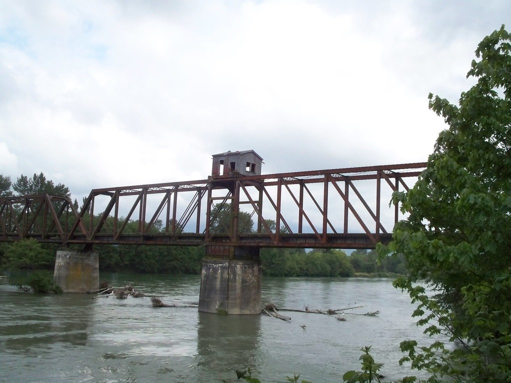 |
| Abandoned swing bridge rail trestle over Skagit River |
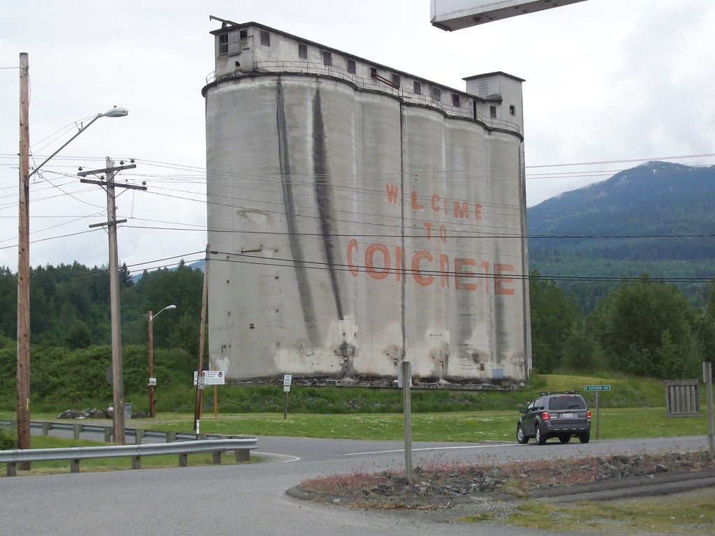 |
| Concrete, Washington! |
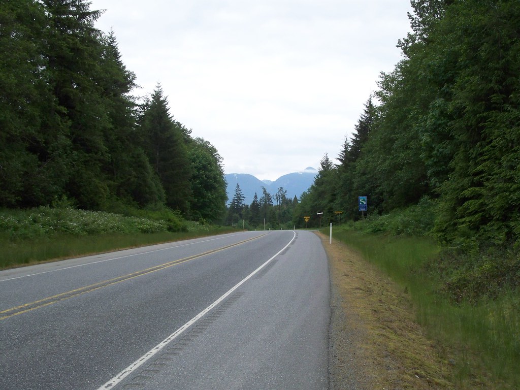 |
| The view from Route 20, looking east to the Cascades |
The second day, Friday June 10, was 35 miles altogether. We started by continuing eastward along the Skagit Valley. The walls of the valley started to narrow more and the Cascades got closer and closer. The first 12 miles was on a quiet backroad that alternated between forest and clearcut with a few shacks thrown in occasionally. That's the thing that gets me about the West of Cascades Northwest: no matter where you go in the countryside, if it isn't protected land, you will see the ugly evidence of the timber industry. Then we arrived in Marblemount, the "last chance" before the "town" of Mazama, some 60 or so miles distant and over a mountain pass. (Yet there is a store in Newhalem, 10 miles up the road?) We duly loaded up on extra groceries as water, because as good little bike tourists, we like to "be prepared". Marblemount also featured a restaurant with a "Bike Food" sign on it, so like the good little bike tourists we were, we stopped in for a bite (hey! Our last chance for a sit-down meal for a while.)
After Marblemount, the scenery really started to get interesting. The Skagit River became more rapid-y, the hills closed in even more. It reminded me of the Clackamas Valley outside of Portland. We did a brief stopover in Newhalem for snacks. After Newhalem, the Skagit formed a narrow valley, the shoulder on Route 20 narrowed as well, and the highway steeply climbed. After a mile or two of grinding up a 7% or so grade (and through a tunnel at said grade, not fun), we saw the first dam of the valley, the Gorge Dam, built and maintained by Seattle City Light. The road leveled out a bit and then descended to river level, then steeply climbed again. We finally rolled into Colonial Creek Campground (North Cascades National Park) around 7 pm. I was a bit worried we'd arrive to a full campground, being a weekend and remembering the ordeal of finding camping at Olympic National Park the year previous, but the place was mostly empty. There was concern about what to do with our food due to animals, especially since there were bear sightings in the vicinity. We were assured by the ranger station down the road that Colonial Creek had communal bear boxes we could use. But after setting up the tent, we found out the bear boxes were on the other side of the campground (the campground divided into two units.) So we put our food in the bathroom as a compromise decision.
 |
| The tunnel! |
 |
| Gorge Dam |
And Saturday? Saturday was the tough one, no matter how we sliced it. From Colonial Creek, it was 27 miles to the first pass, Rainy, and then another 5 to the second, Washington. 32 miles, mostly uphill. And no services or camping. So we'd have to do it all at once. The climbing started immediately after leaving the campground, 8% for a couple miles until things leveled out. A quick descent and then a gradual uphill for awhile. The views were stunning the whole way! Mountains on either side, rushing creek below. The gradual uphill grade of 3 to 4% was too easy, easy enough that we commented about it. Of course, the mountains heard us and kicked it up a notch around the bend.
Despite the climb, the moment was as perfect as could be. Beautiful scenery. Sunny, but not overly warm. We commented during the 4% climbing portion that if it kept up at the present rate we could keep on riding up this hill for days upon end.
 |
| In the Moment. |
No other bicycle tourists were seen, but we saw a bunch of roadies climbing the hill. Most of the ones we ran into were a bunch of friends who do the climb each year in the beginning of June. The constant passing of roadies made us painfully aware of how slow we were going.
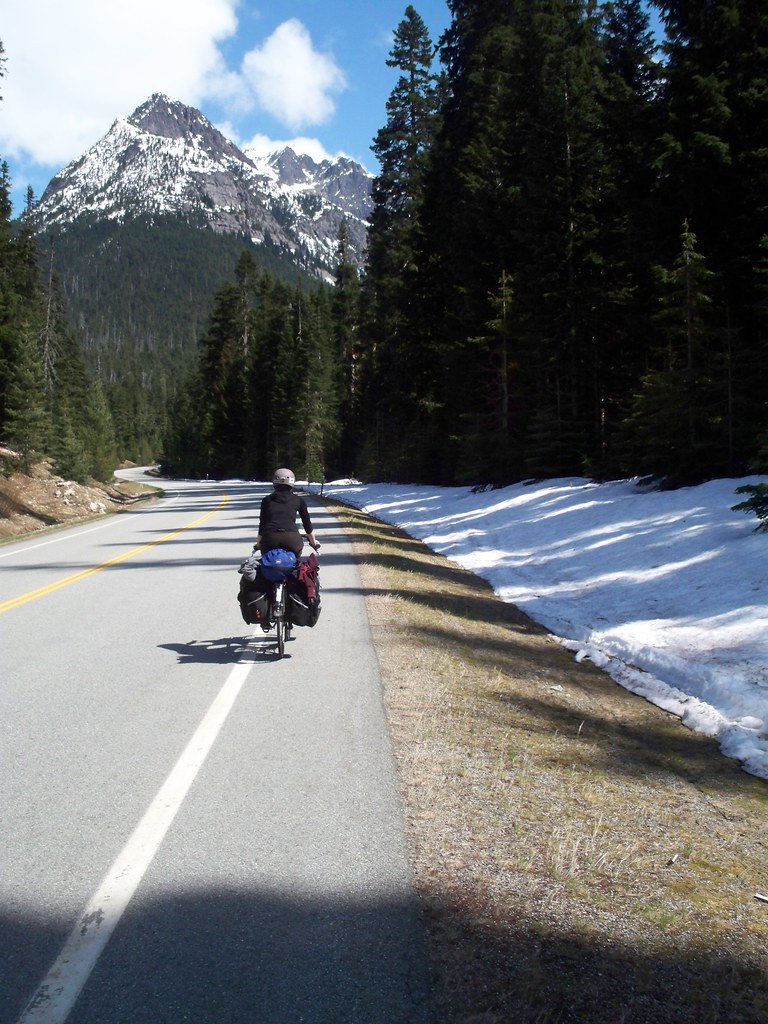 |
| April rides slowly towards Rainy Pass |
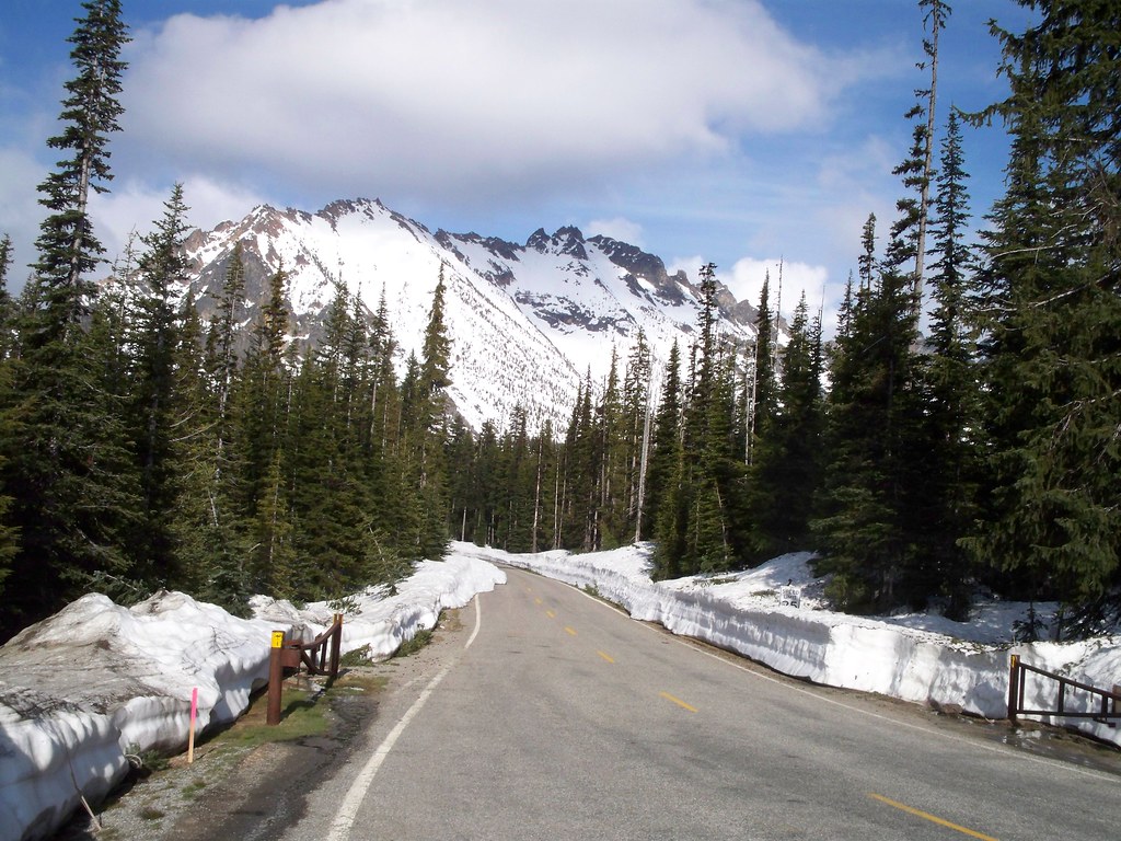
Hours ran into hours and the miles slowly ticked by. At around 3000 feet in elevation, we saw signs of snow in earnest. Climb some more and snow was under trees in shaded areas. Finally around 4000 feet snow was anywhere that wasn't the plowed side of the road.
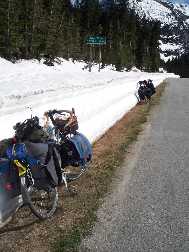
Finally at around 5 pm (nearly seven hours after our start) we summited the first pass, Rainy Pass, elevation 4,855 feet. The snowbanks were several feet high, high deep and thick enough to lean our bikes against! The view from all directions was majestic, words cannot capture (at least from me at this point.) We had a quick snack and then descended for a mile until we had to climb again.
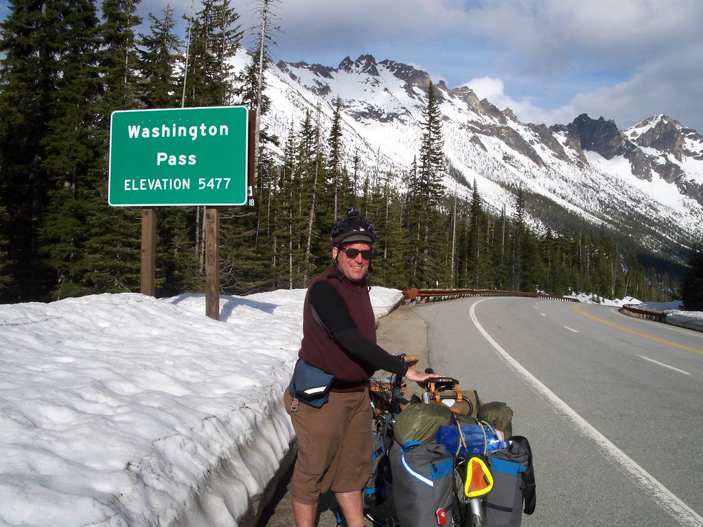
The final climb to Washington Pass seemed more brutal than anything leading up to Rainy, I think mostly due to the fact that we had to descend and then climb. It was one of those moments where I said to myself, "Why am I doing this again?" But finally we reached the top. Washington Pass, 5,477 feet, over a mile high! Now we were finally crossing the Cascades and leaving moist coastal environments for the drier interior West.
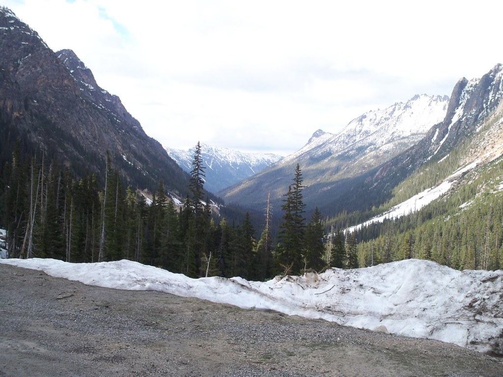
 |
| The View from Washington Pass |
The descent eastward was exhilarating--and fast! Most of it was a 7% down grade. I was doing 30 mph on the average, and reached a top speed of 38.6 mph. At that speed you start to worry about your bike catastrophically failing or something falling off the bike! But thankfully, nothing went wrong. And the scenery--epic! It totally beat anything we saw coming up. Reminded me almost of Lord of the Rings country. The big pity was that it went by soooo fast.
It took us no time to reach the bottom. We were in the Methow River Valley, and the dry side. Douglas fir gave way to Ponderosa Pine and the hills in the distance were scrubby looking. But it was still almost 30 miles to Twisp, where we'd spend the night, and it was after 7pm. We could have camped somewhere close by, but we'd be able to stay indoors in Twisp with my friend Amy. So we pushed on, tired as we were. Thankfully, the riding was still somewhat downhill, so we kept up a good speed. Route 20 was quiet, and there was beautiful scenery. We made a quick pause in Winthrop, a town with an artificial "Old West" aesthetic, where we got some supplies and I wolfed down a hot fudge sundae like I had never eaten before. By the time we got to Amy's house, it was well after dark, and we were beat. All the better reason to spend a day at Amy's on Sunday as a rest day.
Don't forget to check out my new flickr page for all the exciting photos!
Sounds awesome. Way to go.
ReplyDeleteLovely photos on Flicker of the North Cascades! You both are still smiling so that's a good sign.
ReplyDelete