
We decided to have a half-day in Spokane on Sunday June 19th (Day 24 of our journey). Our gracious hosts, John and Leah, put up with us for two nights in their teeny apartment, but they needed their space. We were going to try to find another person to host us for one more night, but nothing turned up. So the plan was hatched: ride to Liberty Lake campground, about 20 miles east of downtown Spokane and off of the Centennial Trail, the main west-east bike trail through the Spokane River valley. This way we’d have a jump on our ride to Missoula.
Since it was only 20 miles, we had plenty of time to lollygag. This was mostly spent at Huckleberries, the local natural foods market. We sat in the cafe for hours, eating food and using le internet. While using the internet I managed to find a Warmshowers host who happened to be the same distance east off of the Centennial Trail, so we decided to go with that option instead. We intended to leave town around 4, but somehow we dragged that out until 6. Hey, we only had to go 20 miles, and the sun doesn’t go down until 9.
The riding out of town was relatively pleasant, as it was on a bike path along the Spokane River. And the riding was easy--too easy. That’s probably why I got a flat, my first so far on the trip. (It’s pretty nice that it waited until almost 800 miles in for this.) And of course it was a rear flat. I didn’t relish removing all the stuff from the bike, so I attempted to fix the flat “Copenhagen Style”--pull out the tube and patch it while the wheel was still on the bike. They do it that way in Copenhagen because rear wheels on traditional roadsters are very hard to remove. Whether or not this was an “easier” way of doing things is hard to say, as it took about as long to do this as it would be for the traditional “remove bags, flip bike upside down, remove wheel” method we Americans love to do, and getting the tire back into the rim was a pain in the ass. Plus, all the jostling of the wheel in the frame caused the fender to come out of whack, rubbing against my tire. (The new tires I got, 700x35C were fatter than the old ones, leaving not much clearance.) For a few miles the fender caused an annoying rub until I futzed with it enough in the failing light for it to not do it as much.
And despite our best intentions, we rolled up to our Warmshowers hosts, Jen and Zack, a little after dark. The last few miles was through rural darkness with our headlights showing the way. After having this happen a couple times in the last week we were trying to avoid this from happening again. So much for that. If we had gotten on the road earlier...Anyway, Jen and Zach were the most gracious hosts* especially since I contacted them the same day. We got our own room and I got some ice cream too.
Monday morning (June 20th, Day 25 of trip) was gorgeous. Too bad our lazy asses rolled out of bed quite late. Comfortable beds are both good and bad on bike tours. We didn’t leave their house until noon, and we had a 55 mile day ahead of us. It was only a couple miles until the Idaho state line. There was no sign at the border (so much for photo-op), but the abundance of tobacco shops announced our arrival into the Potato State. We were on a crappy suburban road for a bit, then got back onto the Centennial Trail. This is where we encountered a gaggle of other touring bicyclists. They appeared to be a family with multiple young girls, some of them on tandems. They were heading in the same direction as us, towards Montana via the Trail of the Coeur d’Alenes.
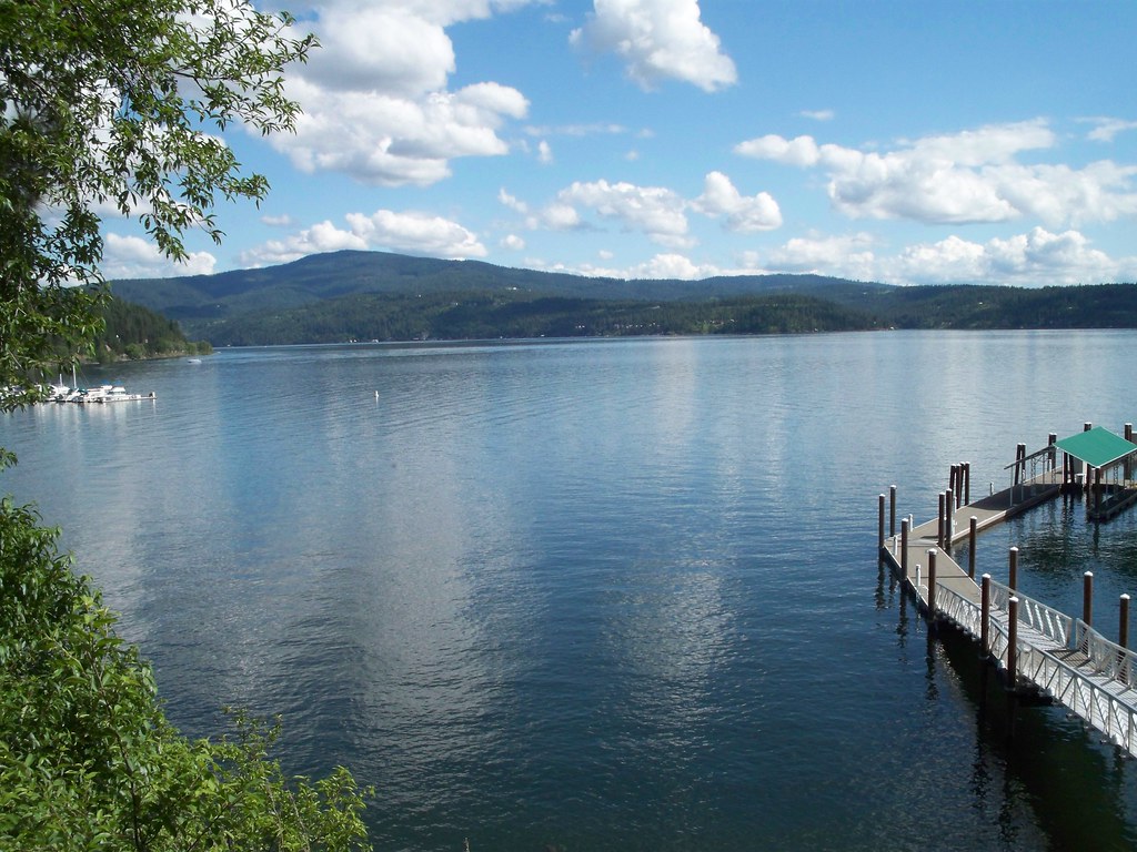
The rest of the ride into Coeur d’Alene, the next city, was pleasant if not uneventful. As is the case with most separated bike trails in the States, there were a few segments on neighborhood streets, plus a few miles alongside I-90 which was very rolling. Coeur d’Alene itself was weird, a touristy lakefront town filled with people with money and teenagers with little to do. We got stares from folks as we walked our loaded bikes down the main street in search of something to eat. Nothing looked appealing or cheap, so we got some coffee and ate food on the outside of town.
At this point, the last 5 miles of the Centennial Trail hugged the north shore of Lake Coeur d’Alene. From there we had the option of getting on I-90 for a mile and then getting off at the Route 97 exit, of which we would follow south along east shore of the lake for about 25 miles to Harrison where we could get on the Trail of the Coeur d’Alenes. Or if we didn’t feel like dealing with freeway traffic we could take the back way, which would be about 5 miles longer to intersect with 97. At least that’s what my searching on Google Maps (and vague wording on the trail’s website) seemed to indicate.
Well, the Centennial Trail did lead to I-90. But rather than have a connection onto the freeway, the trail went up a steep hill. So we rode up the hill, figuring this is how we’d connect. But there was nothing at the top but a picnic area. We saw a roadie up there (the trail at this point seemed popular with racers) who was turning around to head back into town. She asked us where we were heading. “Harrison!” “Well, have a good ride!” She didn’t indicate that there was no way to get there from the end of this trail. So we went back down the hill and went under an overpass that was closed to cars. This might be the “back way” that Google Maps indicated. No luck. The road quickly turned to a narrow rocky path. It might eventually get us to where we needed to go, but it might require some bushwhacking to get there, something we didn’t want to do with our bikes. This is what I get for trusting Google Maps.
So this brought us back to the I-90 option. Now I know what some of you readers may be thinking, “Bicycling on an interstate? Is that even legal? Or safe?” Well, in the western States most interstates are legal for bicycles to ride on as long as they aren’t in urban areas. As for safety, they have a nice wide (though debris-strewn) shoulder, so the 70 mile an hour traffic passes you from a safe distance. Are they fun to ride? Usually not. I only ride on them when there isn’t another option. And our options were running out. We could ride back 5 miles to Coeur d’Alene and get on 90 from the nearest on-ramp. This would mean 10 extra miles of riding, and 90 climbs a bit between here and there. We could also go back to Coeur d’Alene and head south on US 95, which follows the west side of the lake. This route would be longer and have quite a bit of traffic. Or, we could hop the barrier and get on 90 where the trail meets the freeway. Now riding a bike on 90 isn’t illegal, but crossing a barrier to get onto it probably is. But we weren’t the first or last to think of hopping a fence, as someone had already pushed the fence down at its lowest point so folks could surmount it. So we took off our bags, lifted our bikes over the barrier, and remounted everything, hoping a State Trooper would happen to pass by at this moment.
The freeway ride went off without incident and we quickly exited I-90 at the Route 97 exit. We headed a few miles down and came upon the turnoff to the Beauty Creek Campground in the Idaho Panhandle National Forest. At this point it was almost 6pm. It was at least another 20 miles of riding until the next campground, and we had maybe another 3 hours of daylight. We could push on, but neither of us relished a repeat of pushing on until or past dark, tired, weary, riding with headlights and setting up a tent in the dark. Yeah, we had only gone 31 miles, but rather enjoy the camping experience and try for a longer day tomorrow. So we decided to camp at Beauty Creek for the night.
While we were setting up camp, we wondered how the bike touring family was faring. They were supposedly heading the same way we were, and I didn't think they would try the same “hop a fence onto I-90“ business that we did. No sooner did we say that when we turned around and saw all nine of them pull up! Turns out they did the same thing we did, but figured out that there was a break in the fence that allowed them to move the chainlink and not have to lift bikes. (Oops.)
*Yep, I’ve used that term twice in this post. So sue me. As Cahoon said, “Blood from a stone.”
Google Maps is not always your friend. In many rural areas, it's plain wrong. Tomas and I found that out earlier this year, when GMaps repeatedly showed us roads in Central Oregon which did not exist, or which existed only as trails - one went straight through a river, which I suppose is fine in August, but not fordable in May.
ReplyDeleteAlthough my trip is a bit hampered by using the "official" Adventure Cycling routes, they do have the advantage of being largely correct. (Even ACA's TransAm maps are occasionally wrong, like the road that ODOT removed from service on TransAm section 1 west of Grande Ronde)