So the weekend didn't really go like I hoped it would. No Dalles Mountain 60, no bike camping.* I did go on the Women's History bike ride on Saturday, though only for a while. For some reason I thought I was getting a rear flat (and people were telling me that it looked low) so I bailed halfway in order to go home to fix it. But there was no flat. It just looks that way due to the lowish pressure (65psi) in the rear. I did get to meet The Knit Cycle on the ride, though, so it all wasn't bad.
Sunday rolled around. We rolled out of bed late, which I'd like to blame on Daylight Savings Time, but really, having no set schedule just means it's hard to get out of bed at a decent hour. "Breakfast" was made (though it was past morning by now) and various wonderful timekillers were found on the Internet. Then I looked at the clock. Four p.m.? Sheesh.
Time to get out of the house. Why don't I take a walk?
I haven't taken many "walk" walks as of late. I love bicycling, don't get me wrong, but there's something about walking...seeing things on an even more intimate, slower level, the ability to stop in my tracks to analyze something, without having to work about traffic, the different type of exercise one gets from walking for a few hours. I normally walk more in the winter months, as the rainy season seems to compel it. But besides the usual walks to the market, I really haven't been on any long walks this winter.
Now that I decided I wanted to walk, where to? I decided to head south from my apartment across busy SE Powell Boulevard into the Brooklyn neighborhood. (Yeah I know what you're thinking: what an original name. But the neighborhood was originally called "Brookland" due to the numerous streams found in its lowlands. Somewhere along the way someone decided to tweak the spelling a bit so it matches the name of the larger, more popular city/borough Back East.)
Brooklyn is an interesting anomaly. Even though its northern boundary is technically only a block from my domicile, I rarely go there. There are two primary reasons for this: Brooklyn is possibly SE Portland's most "cut-off" neighborhood, as its boundaries are roughly SE Powell Boulevard to its north, SE McLoughlin Boulevard to its west and south, and the old Southern Pacific (now Union Pacific) tracks to its east.** SE Powell is a state highway (US 26) and is treated as such by vehicles. SE McLoughlin is another state highway (US 99E) and if it wasn't for a couple traffic lights on it, it might as well be a freeway. And the railroad tracks...are railroad tracks. So getting into the neighborhood by foot or bicycle takes a little bit of effort and some fortitude. I find it easier to go around Brooklyn, either via SE 26 and 28th Avenues to the east or the Springwater Corridor bike path that is between the river and McLoughlin to the west.
But if there was a reason to get into Brooklyn, I'd go there. But there usually isn't. It's a relatively quiet neighborhood, with a handful of neighborhood-oriented businesses, but nothing I couldn't get elsewhere.
I had no goal other than to wander around. I walked 'cross busy Powell at the SE 21st Ave intersection and started exploring. This part of the 'hood is next to the tracks, and due to that nature it's a mix of light industrial with some older houses interspersed. Many of these houses would go for serious bucks if they were in a different part of town, but they aren't, so most of them look worn down. These are the types of places twentysomethings move to because they're cheap and no one cares about how much noise you make. Perfect for bands, people who like to have raging parties, and mutant freak bike gangs like Chunk 666, who happen to reside here.
But soon! It was time to cross over into true Brooklyn. This meant one of two ways: the sketchy Lafayette bridge, or use the pedestrian "path" along Powell. I opted for the latter, watching out for the broken glass, piles of people and their stuff, and the smell of piss as I navigated where the path goes underneath the railroad tracks. (See what I'm saying about fortitude?) And then I was at Brooklyn's main drag, SE Milwaukie Ave.
Milwaukie once upon a time had a streetcar line, as evidenced by the preponderance of "streetcar era" commercial buildings lined along its course. But the interesting thing here is despite the preponderance of all these buildings, the neighborhood hasn't really gentrified, and due to the separated nature of the neighborhood, probably won't. I'm not saying this area is "run-down", though it definitely was in the 1970's, it's just that it hasn't become a strip of cool, hip stuff like Hawthorne, Mississippi, Belmont, NW 23rd, NE 28th, Alberta, etc. There are a few destinations like the Aladdin Theatre, but most of it is humbler neighborhood institutions like teriyaki restaurants, laundromats, coffee shops, and quite a few business that had "by appointment only" signs. There seemed to me more offices than storefronts, and still a few buildings that have no businesses in them.
Milwaukie is one of the few through routes through the neighborhood, and while it doesn't have a bike lane, I have used it as a bike route in the past, despite moderate levels of traffic.*** But I've never walked down it. First time for everything I guess. I followed it south until SE Holgate Blvd, close to the neighborhood's southern boundary, then turned westward into the "hill" part of the neighborhood.
The hill is filled with decent houses spanning the eras. Brooklyn at its best was a working-to-middle class neighborhood, and the housing stock reflects this; more middle class on the hill, more working class on the flats. Most of the houses have been either restored or kept up. Even though the architectural vernacular here is decidedly "West Coast with a Northwestern Flavor", at times I couldn't help but feel that Brooklyn reminded me a bit of the neighborhoods where I grew up. Maybe it's because of the number of multi-family houses here? While it's not a large number (especially compared to Back East), there were a few, more so than many neighborhoods in this overwhelmingly single-family city.
This part of the 'hood is fairly small and it wasn't long before I was up against busy almost-freeway McLoughlin Boulevard. I could peer into the distance and see the other world on the west side of the Willamette.
But then I came upon the crown jewel of the neighborhood: the Johan Poulsen House. Built in 1892 for a lumber baron, this Queen Anne mansion overlooks McLoughlin, Powell, the Ross Island Bridge, and the city in general.
From there I meandered into the "flats" section of the neighborhood: closer to the tracks, more modest houses intended for workers. There's quite a few narrow streets like SE Pershing Street with small houses butting up against the sidewalk. For some reason this part of the neighborhood with its working-man Victorian aesthetic reminds me of Oakland.
But now I had to get out of the neighborhood. This time I'd use the sketchy looking, sketchy feeling Lafayette St Bridge that goes over the Southern Pacific Tracks. (See, fortitude!)
It's great that there's a bridge, but a bridge like this does not instill confidence in me. Especially when the steps look like this:
Every time I cross I hope to myself that there won't be an earthquake while I cross the bridge.
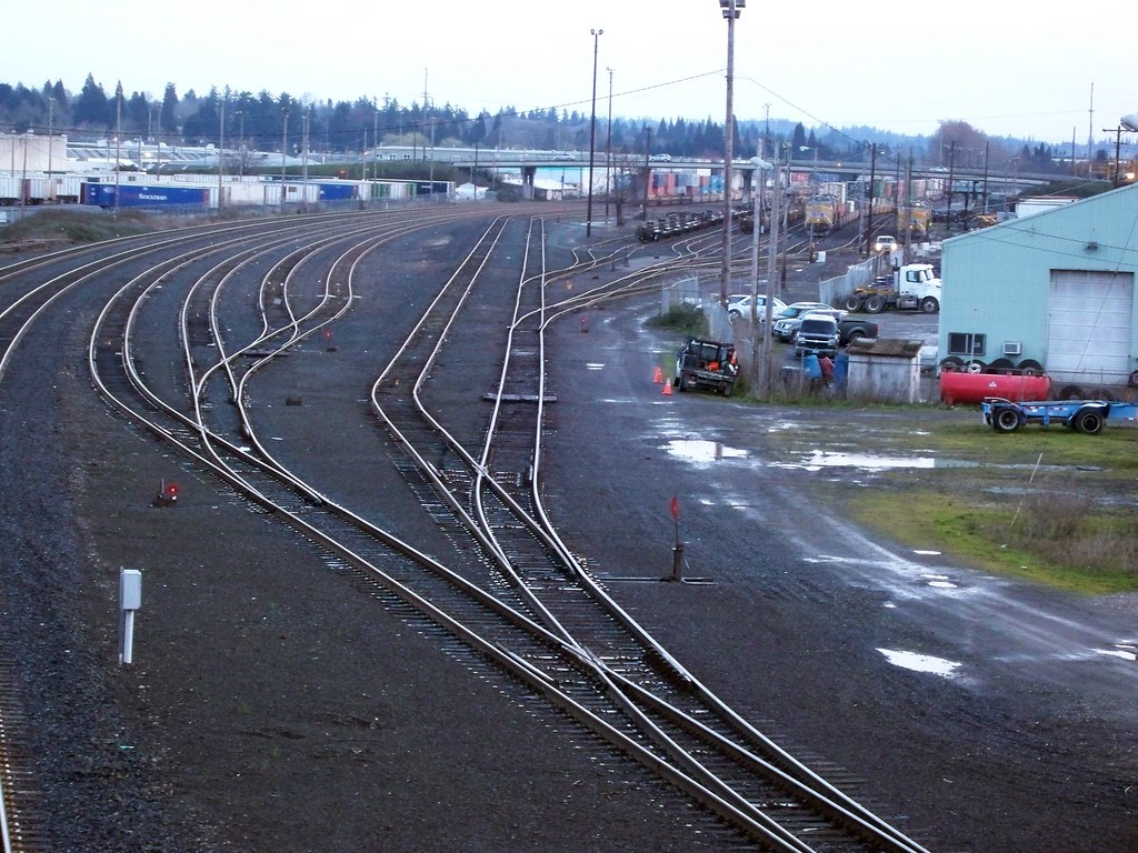
Still, there's some good views of the Brooklyn rail yards if you're into that type of thing.
And before I knew it, I was home. A little tired, a little hungry. And happy that I took a walk.
*I heard that "we", as in Cycle Wild, had eight participants on the Milo McIver camping trip. I'm happy for that, but listening to how much it poured last night, I was happy to be indoors.
**If we're going to get technical, technically the western boundary is the Willamette River. But McLoughlin has cut off all access to it, unless you feel like tumbling down a steep slope. And the eastern boundary north of Holgate Blvd is SE 28th, but since the tracks are west of that, the rump part of Brooklyn east of the tracks might as well not be part of the main neighborhood. A rickety pedestrian bridge, a sketchy pedestrian underpass, and a high-speed bridge are not great neighborhood connections.
***The only other north-south avenue that comes close to a through route is SE 17th. I've used this route as an express between Sellwood and my house. It hugs the industrial edge of the hood, and has quite the rough pavement.
Sunday rolled around. We rolled out of bed late, which I'd like to blame on Daylight Savings Time, but really, having no set schedule just means it's hard to get out of bed at a decent hour. "Breakfast" was made (though it was past morning by now) and various wonderful timekillers were found on the Internet. Then I looked at the clock. Four p.m.? Sheesh.
Time to get out of the house. Why don't I take a walk?
I haven't taken many "walk" walks as of late. I love bicycling, don't get me wrong, but there's something about walking...seeing things on an even more intimate, slower level, the ability to stop in my tracks to analyze something, without having to work about traffic, the different type of exercise one gets from walking for a few hours. I normally walk more in the winter months, as the rainy season seems to compel it. But besides the usual walks to the market, I really haven't been on any long walks this winter.
Now that I decided I wanted to walk, where to? I decided to head south from my apartment across busy SE Powell Boulevard into the Brooklyn neighborhood. (Yeah I know what you're thinking: what an original name. But the neighborhood was originally called "Brookland" due to the numerous streams found in its lowlands. Somewhere along the way someone decided to tweak the spelling a bit so it matches the name of the larger, more popular city/borough Back East.)
Brooklyn is an interesting anomaly. Even though its northern boundary is technically only a block from my domicile, I rarely go there. There are two primary reasons for this: Brooklyn is possibly SE Portland's most "cut-off" neighborhood, as its boundaries are roughly SE Powell Boulevard to its north, SE McLoughlin Boulevard to its west and south, and the old Southern Pacific (now Union Pacific) tracks to its east.** SE Powell is a state highway (US 26) and is treated as such by vehicles. SE McLoughlin is another state highway (US 99E) and if it wasn't for a couple traffic lights on it, it might as well be a freeway. And the railroad tracks...are railroad tracks. So getting into the neighborhood by foot or bicycle takes a little bit of effort and some fortitude. I find it easier to go around Brooklyn, either via SE 26 and 28th Avenues to the east or the Springwater Corridor bike path that is between the river and McLoughlin to the west.
But if there was a reason to get into Brooklyn, I'd go there. But there usually isn't. It's a relatively quiet neighborhood, with a handful of neighborhood-oriented businesses, but nothing I couldn't get elsewhere.
I had no goal other than to wander around. I walked 'cross busy Powell at the SE 21st Ave intersection and started exploring. This part of the 'hood is next to the tracks, and due to that nature it's a mix of light industrial with some older houses interspersed. Many of these houses would go for serious bucks if they were in a different part of town, but they aren't, so most of them look worn down. These are the types of places twentysomethings move to because they're cheap and no one cares about how much noise you make. Perfect for bands, people who like to have raging parties, and mutant freak bike gangs like Chunk 666, who happen to reside here.
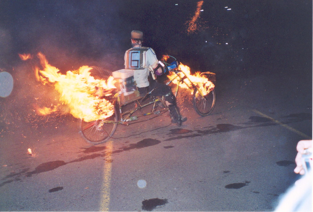 |
| From Chunkathalon 2002, by Megulon 5. Ten years ago? How time flies. |
But soon! It was time to cross over into true Brooklyn. This meant one of two ways: the sketchy Lafayette bridge, or use the pedestrian "path" along Powell. I opted for the latter, watching out for the broken glass, piles of people and their stuff, and the smell of piss as I navigated where the path goes underneath the railroad tracks. (See what I'm saying about fortitude?) And then I was at Brooklyn's main drag, SE Milwaukie Ave.
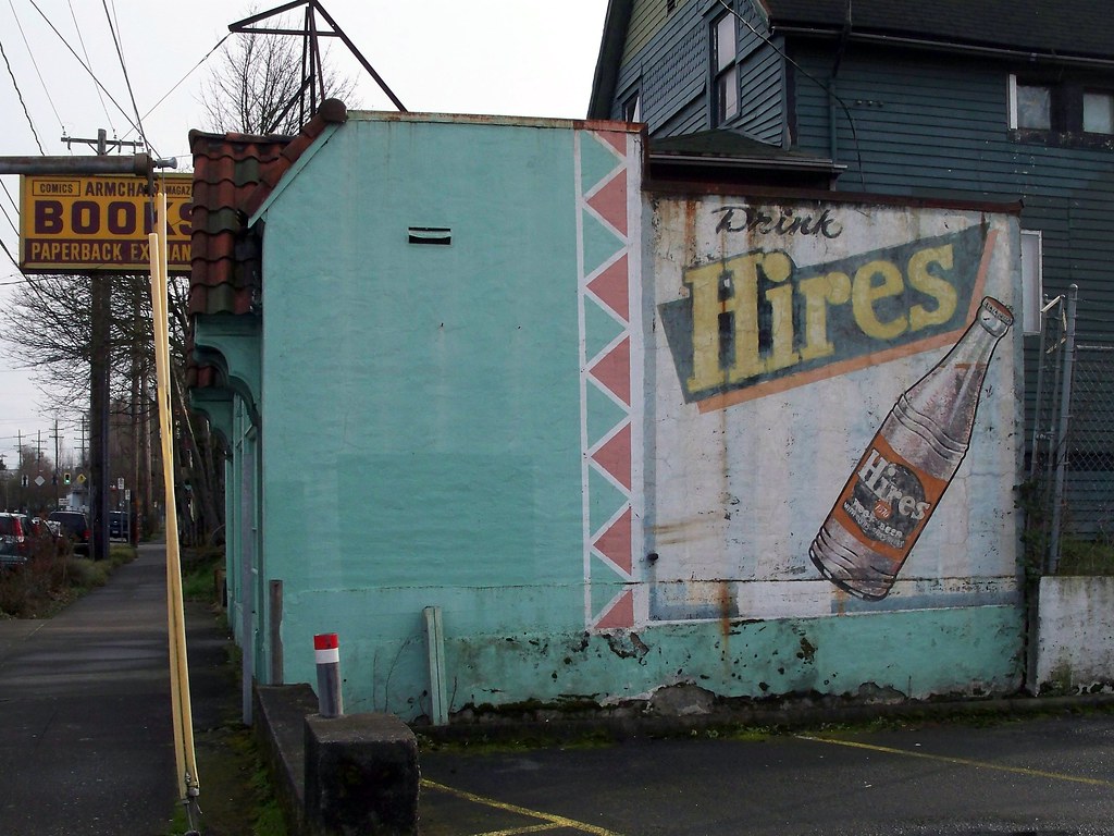
Milwaukie once upon a time had a streetcar line, as evidenced by the preponderance of "streetcar era" commercial buildings lined along its course. But the interesting thing here is despite the preponderance of all these buildings, the neighborhood hasn't really gentrified, and due to the separated nature of the neighborhood, probably won't. I'm not saying this area is "run-down", though it definitely was in the 1970's, it's just that it hasn't become a strip of cool, hip stuff like Hawthorne, Mississippi, Belmont, NW 23rd, NE 28th, Alberta, etc. There are a few destinations like the Aladdin Theatre, but most of it is humbler neighborhood institutions like teriyaki restaurants, laundromats, coffee shops, and quite a few business that had "by appointment only" signs. There seemed to me more offices than storefronts, and still a few buildings that have no businesses in them.
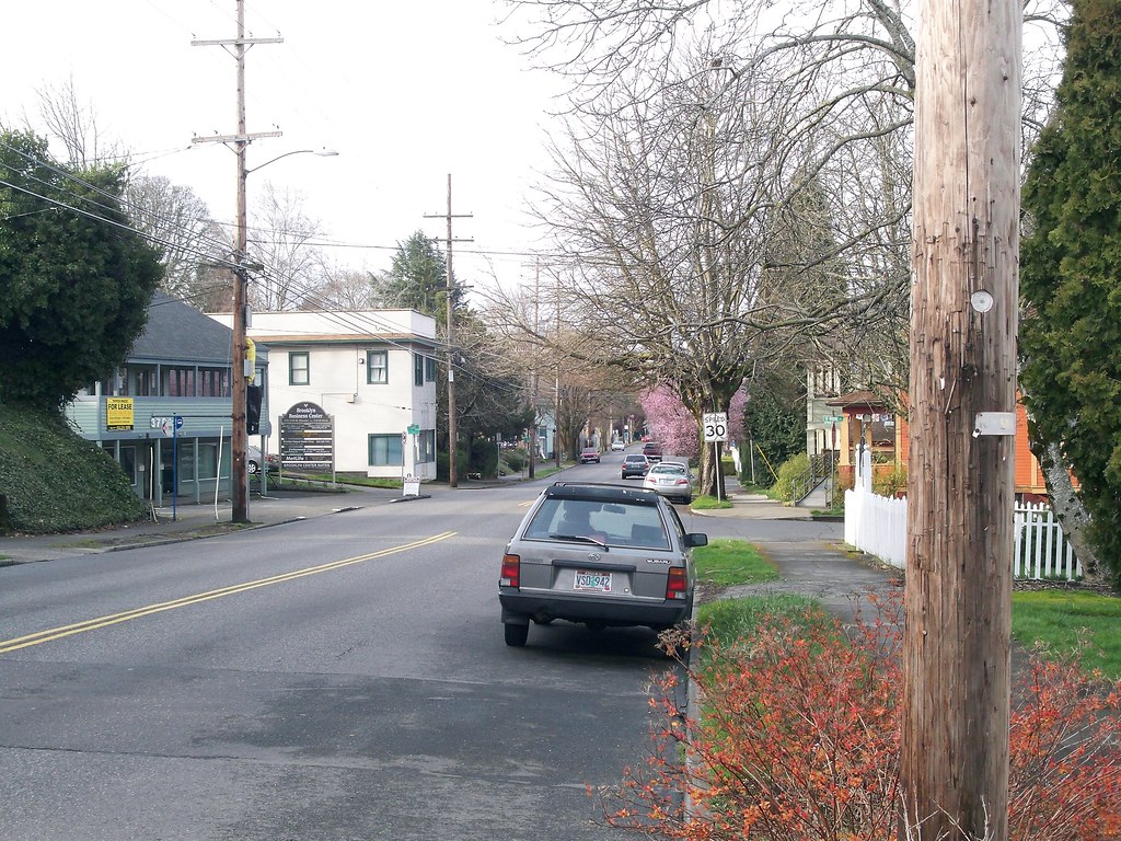
Milwaukie is one of the few through routes through the neighborhood, and while it doesn't have a bike lane, I have used it as a bike route in the past, despite moderate levels of traffic.*** But I've never walked down it. First time for everything I guess. I followed it south until SE Holgate Blvd, close to the neighborhood's southern boundary, then turned westward into the "hill" part of the neighborhood.
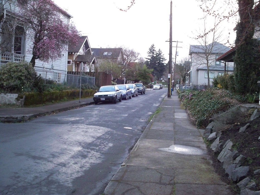
The hill is filled with decent houses spanning the eras. Brooklyn at its best was a working-to-middle class neighborhood, and the housing stock reflects this; more middle class on the hill, more working class on the flats. Most of the houses have been either restored or kept up. Even though the architectural vernacular here is decidedly "West Coast with a Northwestern Flavor", at times I couldn't help but feel that Brooklyn reminded me a bit of the neighborhoods where I grew up. Maybe it's because of the number of multi-family houses here? While it's not a large number (especially compared to Back East), there were a few, more so than many neighborhoods in this overwhelmingly single-family city.
This part of the 'hood is fairly small and it wasn't long before I was up against busy almost-freeway McLoughlin Boulevard. I could peer into the distance and see the other world on the west side of the Willamette.
But then I came upon the crown jewel of the neighborhood: the Johan Poulsen House. Built in 1892 for a lumber baron, this Queen Anne mansion overlooks McLoughlin, Powell, the Ross Island Bridge, and the city in general.
From there I meandered into the "flats" section of the neighborhood: closer to the tracks, more modest houses intended for workers. There's quite a few narrow streets like SE Pershing Street with small houses butting up against the sidewalk. For some reason this part of the neighborhood with its working-man Victorian aesthetic reminds me of Oakland.
But now I had to get out of the neighborhood. This time I'd use the sketchy looking, sketchy feeling Lafayette St Bridge that goes over the Southern Pacific Tracks. (See, fortitude!)
It's great that there's a bridge, but a bridge like this does not instill confidence in me. Especially when the steps look like this:
Every time I cross I hope to myself that there won't be an earthquake while I cross the bridge.
Still, there's some good views of the Brooklyn rail yards if you're into that type of thing.
And before I knew it, I was home. A little tired, a little hungry. And happy that I took a walk.
*I heard that "we", as in Cycle Wild, had eight participants on the Milo McIver camping trip. I'm happy for that, but listening to how much it poured last night, I was happy to be indoors.
**If we're going to get technical, technically the western boundary is the Willamette River. But McLoughlin has cut off all access to it, unless you feel like tumbling down a steep slope. And the eastern boundary north of Holgate Blvd is SE 28th, but since the tracks are west of that, the rump part of Brooklyn east of the tracks might as well not be part of the main neighborhood. A rickety pedestrian bridge, a sketchy pedestrian underpass, and a high-speed bridge are not great neighborhood connections.
***The only other north-south avenue that comes close to a through route is SE 17th. I've used this route as an express between Sellwood and my house. It hugs the industrial edge of the hood, and has quite the rough pavement.





Nice bit of local history (I enjoy such). Makes me want to go explre more of my own town (Bristol,VA),learn more of it's history,being long time visitors,but new residents. Problem for me is,that while sometimes Ican pedal 50+ miles in one stretch,with my spinal injuries (now nearly 11 years old),I can hardly walk a few hundred yards and I'm down for the week unable to or barely walking...sigh-makes it intersting taking the kids on vacation as some places won't allow a bike (I gues they don't believe one can pedal and not walk,LOL!).
ReplyDeleteEnjoyed the virual walk with you though :)
The Disabled Cyclist
Thanks for that insight into this little hood. I lived in Rose City Park in the early 90s, but don't recall Brooklyn at all. But like you said, it is often overlooked.
ReplyDeleteSometimes there is nothing like a long walk.
You had me at Goats! Seriously, nice ride and full detail. I often think how nice it would be to venture into a new "world".
ReplyDelete