Yes, yes, I woulda/coulda/shoulda written this missive a couple days ago. But this week has become busier than expected, with a presentation, fill-in shifts at the hostel, and Tax Day(TM).
Last weekend (Saturday April 14 and Sunday April 15) was yet another camping expedition for yours truly. The bike camping itch is back, and the weekend was great in the weather department: mostly cloudy to mostly sunny, highs in the mid-60's F (around 18C). What better time for more bike camping?
This time I gathered an intrepid group of five: Ed, Steph, Andy, Todd B (who met us in Vancouver, Wash.), and myself. The destination: Sunset Campground on the East Fork Lewis River in Gifford Pinchot National Forest. This small campground in rural Clark County has been "on my radar" for a few years, but because it is out of the way and not on the way to something else, I had never been there before, just heard reports from a few that had. Cycle Wild has been wanting to use Sunset as a camping destination for awhile since it is in the local "rideshed", but since no one had been there before we didn't want to try it sight unseen. Time for a scouting mission!
Steph, Ed, and I met up at the Cameo Cafe in NE Portland for a ridiculously large pre-ride breakfast, then met Andy at the Parkrose MAX station. From Parkrose it would be 38 miles (60 km) to Sunset. The ride itself neatly divided itself into three distinct sections. The first section was about 14 miles and this was suburban riding through East Vancouver (with four miles of using the I-205 bike path/bridge to get to the Washington side of the Columbia River.) While the suburban sprawl of Vancouver is the opposite of "exciting", I lucked upon a route that avoided most of the worst and stuck to either quiet streets or busier streets with a bike lane. Around milepost 12 we hit up a Safeway for supplies and also met Todd B.
The second section was about 10 miles. This was the "bucolic" side of Clark County, rambling through farmlands interspersed with housing. The roads were two-lane affairs sans shoulders, but the traffic generally light. A couple hills were encountered. Around milepost 24 we hit the Heisson Store, which would be the "last chance" food stop before the campground. It was a real treat! Country stores can be hit and miss: some are more pathetic than your standard 7-11 while others truly are a community resource in sparsely populated area. Heisson Store was the latter: well stocked (we could have easily gotten all of our food for the overnight here), friendly owners, and a Post Office too! We chatted with the proprietors for a bit, and Todd gave them his last Clark County Bike Map which they promptly hung up on the wall! (Affecting positive bicycle change in Clark County! Woot!)
The final section was the best, as it followed the scenic East Fork Lewis River upstream into the Cascade Mountains. There were many highlights: the Old Heisson Bridge, Lucia Falls where we had a picnic stop and saw fish try to jump up the falls, and 2 1/2 mile gravel bike path from there to Moulton Falls. After Moulton Falls was the only real grind of the trip: a mile climb at around 6-8% grade, but then an equally steep descent. The final five miles was a bit wearing as we climbed up to an elevation of 1,000 feet. Finally, Sunset Falls at 5pm!
The five of us took over two sites: Todd and Andy with their hammocks plus my bivy in one, Steph and Ed in their "tent" in another. (They brought a tent but forgot the poles, so slept in their sleeping bags.) We set up camp, took a short walk over to Sunset Falls, made food, and hung out around a fire until we were ready to sleep. The night got cold though, probably dropped to just above freezing overnight. My bivy kept me mostly warm but my head got cold. At least I got to look up to the stars!
In the morn we made breakfast, broke camp, departed around 11am, and rode back the way we came.
It was a good, fun trip overall. The only issue besides the lack of tent poles was the lack of potable water. Though the USFS website said there was, we found out upon arriving there wasn't. The camp host let us use some of his supply, but if he didn't we would have to filter/boil water or haul it up from Lucia Falls, 10 miles away. (And we would have done that, had we not been misled by the website.) And like many Forest Service campgrounds, this one is first-come, first-served. And it's popular in the summer. We found out from the camp host that the campground starts filling up on Thursday night! It would be tough for Cycle Wild to pull off a summer weekend trip here; it would be a better destination for a midweek summer campout, or a weekend in spring or fall.
But Sunset is not the only option in the area. Forest Road 42 continues up into the mountains and there's wild camping destinations out there. And near Sunset are a couple Washington State Department of Natural Resources (DNR) campgrounds in the Yacolt Burn State Forest. More adventures!
Maybe if the weather holds I'll go camping again this weekend...
View the route here.
View more photos from me here.
View Andy's photos here.
Last weekend (Saturday April 14 and Sunday April 15) was yet another camping expedition for yours truly. The bike camping itch is back, and the weekend was great in the weather department: mostly cloudy to mostly sunny, highs in the mid-60's F (around 18C). What better time for more bike camping?
 |
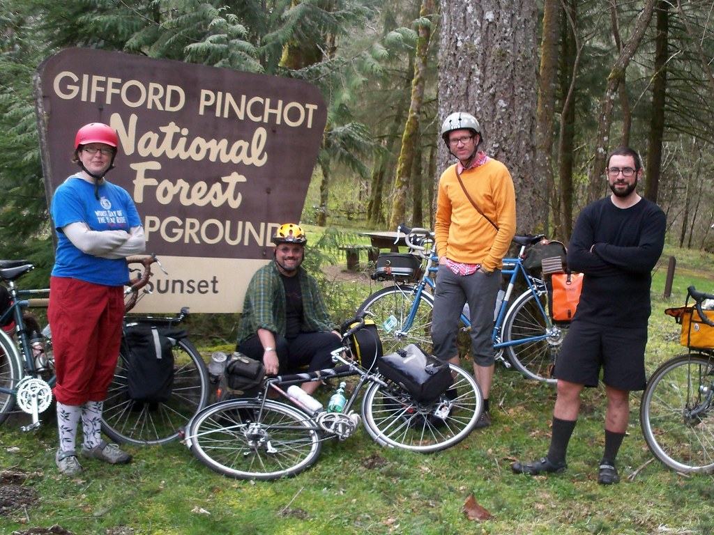
| L to R: Steph, Todd B, Andy, Ed |
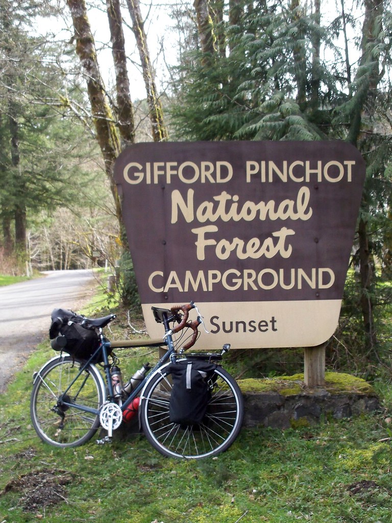
This time I gathered an intrepid group of five: Ed, Steph, Andy, Todd B (who met us in Vancouver, Wash.), and myself. The destination: Sunset Campground on the East Fork Lewis River in Gifford Pinchot National Forest. This small campground in rural Clark County has been "on my radar" for a few years, but because it is out of the way and not on the way to something else, I had never been there before, just heard reports from a few that had. Cycle Wild has been wanting to use Sunset as a camping destination for awhile since it is in the local "rideshed", but since no one had been there before we didn't want to try it sight unseen. Time for a scouting mission!
Steph, Ed, and I met up at the Cameo Cafe in NE Portland for a ridiculously large pre-ride breakfast, then met Andy at the Parkrose MAX station. From Parkrose it would be 38 miles (60 km) to Sunset. The ride itself neatly divided itself into three distinct sections. The first section was about 14 miles and this was suburban riding through East Vancouver (with four miles of using the I-205 bike path/bridge to get to the Washington side of the Columbia River.) While the suburban sprawl of Vancouver is the opposite of "exciting", I lucked upon a route that avoided most of the worst and stuck to either quiet streets or busier streets with a bike lane. Around milepost 12 we hit up a Safeway for supplies and also met Todd B.
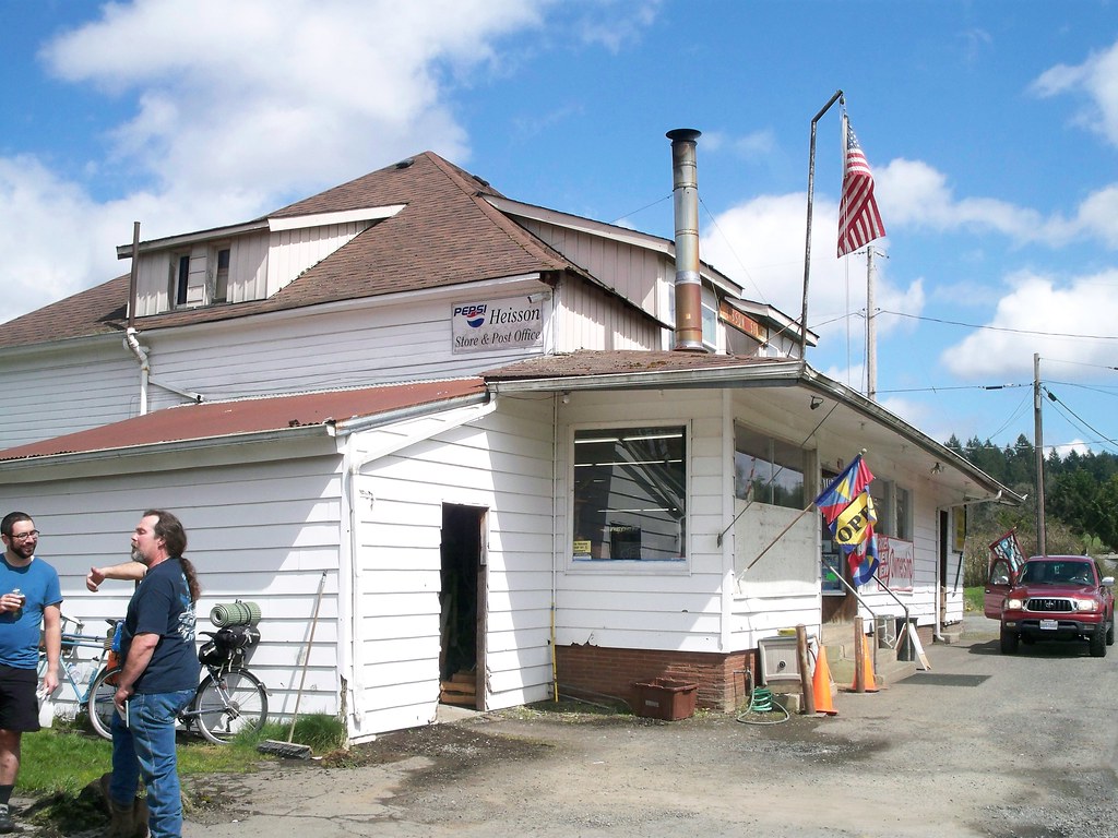
The second section was about 10 miles. This was the "bucolic" side of Clark County, rambling through farmlands interspersed with housing. The roads were two-lane affairs sans shoulders, but the traffic generally light. A couple hills were encountered. Around milepost 24 we hit the Heisson Store, which would be the "last chance" food stop before the campground. It was a real treat! Country stores can be hit and miss: some are more pathetic than your standard 7-11 while others truly are a community resource in sparsely populated area. Heisson Store was the latter: well stocked (we could have easily gotten all of our food for the overnight here), friendly owners, and a Post Office too! We chatted with the proprietors for a bit, and Todd gave them his last Clark County Bike Map which they promptly hung up on the wall! (Affecting positive bicycle change in Clark County! Woot!)
The final section was the best, as it followed the scenic East Fork Lewis River upstream into the Cascade Mountains. There were many highlights: the Old Heisson Bridge, Lucia Falls where we had a picnic stop and saw fish try to jump up the falls, and 2 1/2 mile gravel bike path from there to Moulton Falls. After Moulton Falls was the only real grind of the trip: a mile climb at around 6-8% grade, but then an equally steep descent. The final five miles was a bit wearing as we climbed up to an elevation of 1,000 feet. Finally, Sunset Falls at 5pm!
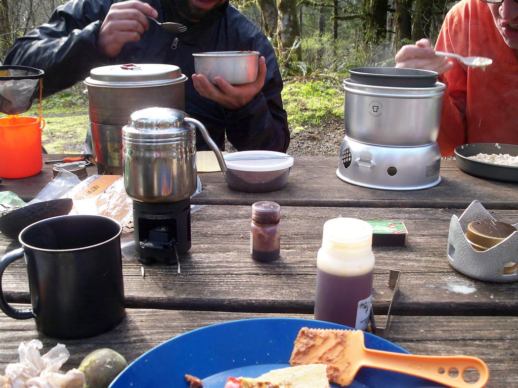
The five of us took over two sites: Todd and Andy with their hammocks plus my bivy in one, Steph and Ed in their "tent" in another. (They brought a tent but forgot the poles, so slept in their sleeping bags.) We set up camp, took a short walk over to Sunset Falls, made food, and hung out around a fire until we were ready to sleep. The night got cold though, probably dropped to just above freezing overnight. My bivy kept me mostly warm but my head got cold. At least I got to look up to the stars!
In the morn we made breakfast, broke camp, departed around 11am, and rode back the way we came.
It was a good, fun trip overall. The only issue besides the lack of tent poles was the lack of potable water. Though the USFS website said there was, we found out upon arriving there wasn't. The camp host let us use some of his supply, but if he didn't we would have to filter/boil water or haul it up from Lucia Falls, 10 miles away. (And we would have done that, had we not been misled by the website.) And like many Forest Service campgrounds, this one is first-come, first-served. And it's popular in the summer. We found out from the camp host that the campground starts filling up on Thursday night! It would be tough for Cycle Wild to pull off a summer weekend trip here; it would be a better destination for a midweek summer campout, or a weekend in spring or fall.
But Sunset is not the only option in the area. Forest Road 42 continues up into the mountains and there's wild camping destinations out there. And near Sunset are a couple Washington State Department of Natural Resources (DNR) campgrounds in the Yacolt Burn State Forest. More adventures!
Maybe if the weather holds I'll go camping again this weekend...
View the route here.
View more photos from me here.
View Andy's photos here.


Sounds like an awesome trip,my friend! pics really tell the tail of the good time had by all too (yours and Andy's). Still yet to take our first bike-camp (Nick and I),kinda waiting on school to let out for summer and gathering needed bits (those panniers will be paramount-still loving them! :) ). Loved the read,my good friend,and happy you got to go :D
ReplyDeleteThe Disabled Cyclist
It IS on the way to somewhere (I hope). That's the beginning of the backroads loop through hood river I'm planning.
ReplyDeleteOoh! Sounds exciting!
Deletethanks for including the route & your commentary; i was eyeing this site, too. but they don't have water? hmmmm.....
ReplyDelete