 |
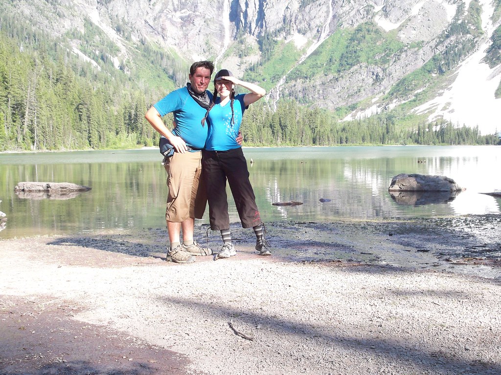
| April and I at Avalanche Lake, Fourth of July 2011 |
But seeing the southern boundary of the park from a train window is not the same thing as actually being in it. In 2003 I made my first real visit. Being the travelling cheapskate I am, I took the plunge because I knew a couple people through zines who were living in Whitefish, the gateway town 30 miles to the west, for the summer. That meant I had a free place to crash for a couple nights.
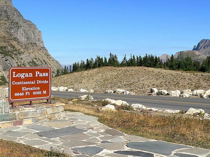
But the summer of 2003 was a bad time to visit. This was the summer of a big forest fire in and around Glacier, something that became obvious as soon as I got off the train in Whitefish. ("Smells like campfire" I thought for a second before realizing it was the forest burning.) The thick haze of smoke hung heavily over the area, obscuring the views. Plus, I was ill prepared for Glacier, not having done any real planning. I could borrow a bike but was informed it was still a 30 mile ride one-way into the west entrance along busy US 2. (My hosts weren't much of bicyclists, otherwise they would have known of the quiet backway to get in that we used a few days ago.) Nor was there any bus to get to the park (or at least a cheap one.) But I still got in because a friend of my host offered the use of her truck for a day. So I cruised up Going-To-The-Sun Road which was smothered in smoky haze as thick as fog. The road offered no views except at the top of Logan Pass. But whatever. I was blasting The White Album and Dark Side of the Moon, the two CDs of the car owner's collection I found tolerable, during the expedition so everything was ok. (Remember when people listened to CDs in cars?)
Fast forward four years to 2007. I was crossing the continent yet again by Amtrak to get to New England for my New Haven-Montreal bike tour. I decided to spend a couple days in Glacier Park again. This time I opted to stay in East Glacier because there was a hostel there, and because I worked at another hostel I could stay for free. (Who says working at a hostel has no perks?) But once again I was not as prepared as I should have been. The big mistake of this visit was timing: September right after Labor Day. Glacier is pretty much a summer park due to its mountains and elevation, and the season is pretty much Memorial Day-Labor Day.* Even though the weather was still great, a lot of stuff had already shut down or was in the process of shutting down, as everything pretty much closes up by October 1st. The free shuttle through the park ends Labor Day, leaving me with the expensive shuttle option. I declined that, and opted to ride to Two Medicine Lake, the closest area in the park to East Glacier Village, instead. That's all I did in the park on that trip. Two Medicine is indeed beautiful, but it's just a tiny smidgen of the park.
So now another four years have lapsed, and I find myself at Glacier Park again. This time I was determined to do it "right". But of course mother nature has other plans.
The main thing I wanted to do for this visit was ride across the width of the park on the beautiful Going-To-The-Sun Road. The road summits the Continental Divide at the epic and beautiful Logan Pass. But the past winter's snow was epic as well. The pass normally opens by mid-June, but by the first week of July it still is closed by snow. Damn. So what to do?
Not to be defeated, we decided to enter the west entrance of the park and spend a couple days there. Then get back onto the main highway (U.S. 2) that travels along the south boundary of the park (and also parallels the Empire Builder route) over Marias Pass. (More about that on a subsequent post.) Then we'd spend a break day at the East Glacier hostel and then a couple more days on the east side of the park before crossing into Canada. This would mean adding more miles and more days than crossing over Logan, but so what? Part of this bike journey is to enjoy the expedition, not "make good time". I want to enjoy Glacier Park, and fuck it, I will!
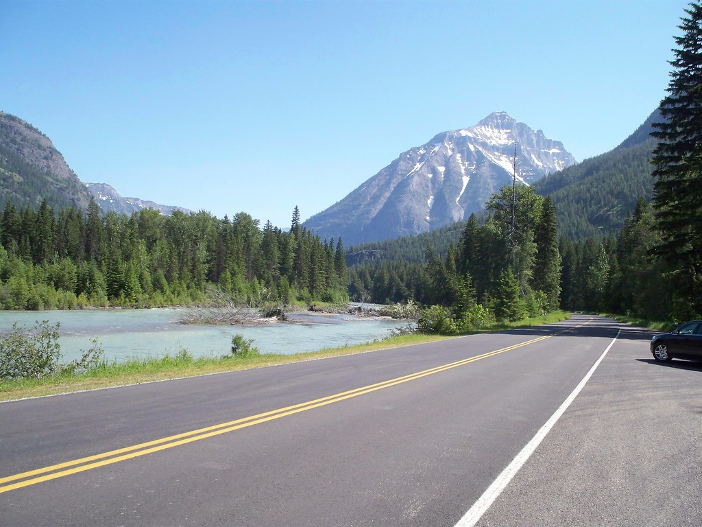
So Sunday July 3rd (Day 38 of this trip for those keeping track) we spent a half day, or rather, three-quarters of a day in Whitefish before hitting the road to Glacier. It was little over 30 miles of riding over the much-quieter than US 2 backway, and we made it to Apgar Campground (two miles after the West Glacier entrance) right as the sun was setting.
Glacier is gracious enough to offer hiker-biker sites in many of the campgrounds, a welcome change from the jockeying for any available space we had to do in Olympic National Park last year. In the hiker-biker site we encountered another couple who was spending a week hiking around the park. Glacier also has bear boxes for storage of foods and odorous items, which is much better than having to worry about hanging food. The only downside was some asshole in the middle of the night threw a bag of garbage into our bear box (which clearly says "NO GARBAGE" on the front.) Not only did they do that, but they left the box open, defeating the point of the bear box AND putting the campsite at risk. Urgh. And how stereotypical: the trash was a Coke can and a Marlboro box in a Walmart bag. God Bless America!
And then it was the Fourth of July! America's B-day, woot! Our riding consisted of a fifteen mile trek up Going-To-The-Sun Road to Avalanche Campground, which was as far in camping-wise we could go on this side of the park with the road closure. This section of Going-To-The-Sun Road is closed to bicyclists between 11am and 4pm, due to safety concerns. (Translation: Even though we are a National Park and are supposed to be about the environment and preserving nature, we still primarily care about cars and RVs. Especially RVs. You bicyclists will get in the way of all these vehicles enjoying the park, and we'd rather not have a traffic jam due to you two-wheeled hippies.) (Okay, snarkiness aside, Glacier does offer free shuttle service on Going-To-The-Sun Road to alleviate congestion and air pollution. Too bad that people weren't using it as much as they should. But the shuttle from Apgar to Avalanche was only running hourly, so I can see why people would rather drive to Avalanche and deal with the lack of parking.) Of course we got out of Apgar at 9:45, so we rode like a bat out of hell to get to Avalanche before the closure.
Avalanche campground was a bit of a mess. Even though it was the busiest weekend of the year for the park, half of the campground was closed off, for use as overflow parking for people wanting to shuttle up to The Loop or hike to Avalanche Lake. And guess what was in the closed section? The hiker/biker site, of course! (See my parenthetical snarkiness in the paragraph above.) The camp host was off duty and the one park employee we could find was unhelpful, so we were at a quandary. Camp at the official hiker/biker spot in the closed loop and be told to move later, or get one of the open spots in the open loop and pay hiker/biker rate ($5/person vs $20/campsite.) We opted for the latter. Later on another park employee informed us we could indeed camp in the closed off hiker/biker spot if we wanted to get the cheaper rate, otherwise we'd have to pay the regular site rate, which is what we did.
But enough grumbling! Let's move to fun!
After we set up camp, we decided to cheat a little bit. While Avalanche marked the end of the road for cars, bicyclists and hikers could travel 11 more miles up Going-To-The-Sun. Or, there was a free shuttle that ran about every 10-15 minutes that brought folks up to The Loop, the big hairpin turn on the road, some 8 miles beyond the gate. We opted for that. Sorry touring purists! (If it makes you feel any better, we spotted two folks on fully loaded bikes riding up the road.) The view from The Loop was gorgeous, and there were lots of people enjoying it as well.
After that we took a four mile round trip hike to Avalanche Lake. The trail first passed by a small gorge that was created by Avalanche Creek, then rose through the forest on the way to the lake. Since this was bear country we were advised to make noise, but there were so many people on the trail we weren't too worried about bear encounters. (We did hear someone mention they spotted a bear on the hillside on the far end of the trail, past where we turned around.) And lots of people indeed! April noticed a particular gentleman owning the same L.A. Bike Summit 2009 t-shirt that I own, and sure enough, I recognized that it was Noah Budnick of Transportation Alternatives in New York. In the middle of nowhere I find people I know. Small world!
The lake was beautiful as well, but our feet were sore. Amazing! After 1,200 miles of riding, a four mile hike put us out of commission! We opted to dip our sore feet into the icy cold waters of McDonald Creek to cool off. That lasted a couple seconds.
Tuesday we took a shuttle back to the west gate and rode 50-some miles over Marias Pass to get to the east side of the park. More on that in the next post.
Side note: I know, all I'm saying about what we see is "It's Awesome! It's Beautiful!" Just look at the pictures on my flickr to get the true appreciation.
But enough grumbling! Let's move to fun!
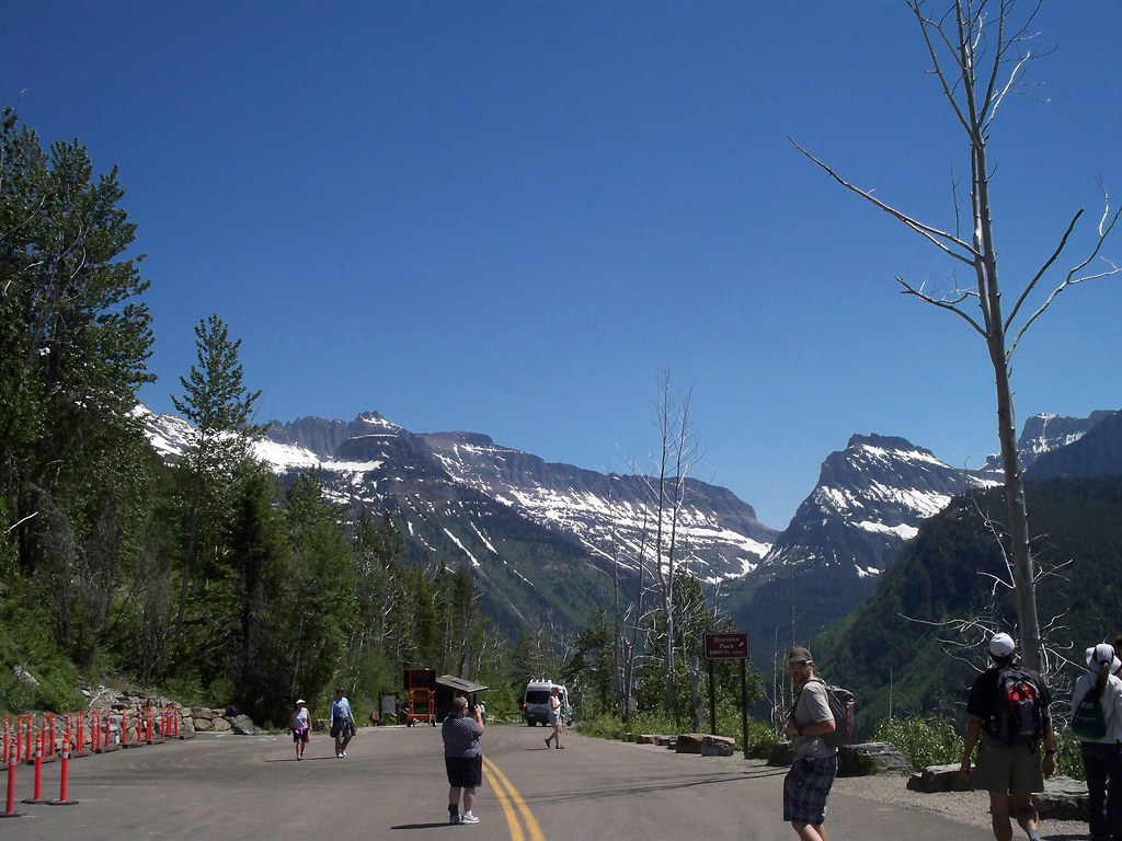 |
| The view from The Loop |
After we set up camp, we decided to cheat a little bit. While Avalanche marked the end of the road for cars, bicyclists and hikers could travel 11 more miles up Going-To-The-Sun. Or, there was a free shuttle that ran about every 10-15 minutes that brought folks up to The Loop, the big hairpin turn on the road, some 8 miles beyond the gate. We opted for that. Sorry touring purists! (If it makes you feel any better, we spotted two folks on fully loaded bikes riding up the road.) The view from The Loop was gorgeous, and there were lots of people enjoying it as well.
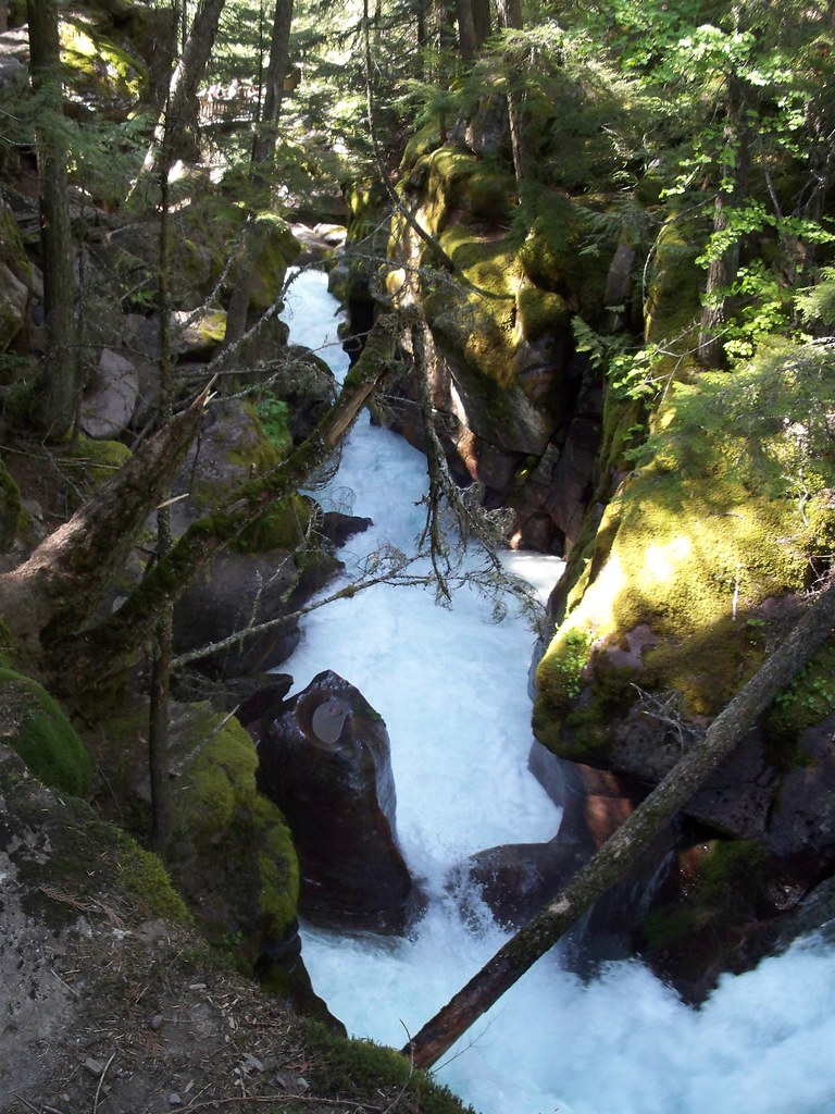 |
| Avalanche Gorge |
After that we took a four mile round trip hike to Avalanche Lake. The trail first passed by a small gorge that was created by Avalanche Creek, then rose through the forest on the way to the lake. Since this was bear country we were advised to make noise, but there were so many people on the trail we weren't too worried about bear encounters. (We did hear someone mention they spotted a bear on the hillside on the far end of the trail, past where we turned around.) And lots of people indeed! April noticed a particular gentleman owning the same L.A. Bike Summit 2009 t-shirt that I own, and sure enough, I recognized that it was Noah Budnick of Transportation Alternatives in New York. In the middle of nowhere I find people I know. Small world!
The lake was beautiful as well, but our feet were sore. Amazing! After 1,200 miles of riding, a four mile hike put us out of commission! We opted to dip our sore feet into the icy cold waters of McDonald Creek to cool off. That lasted a couple seconds.
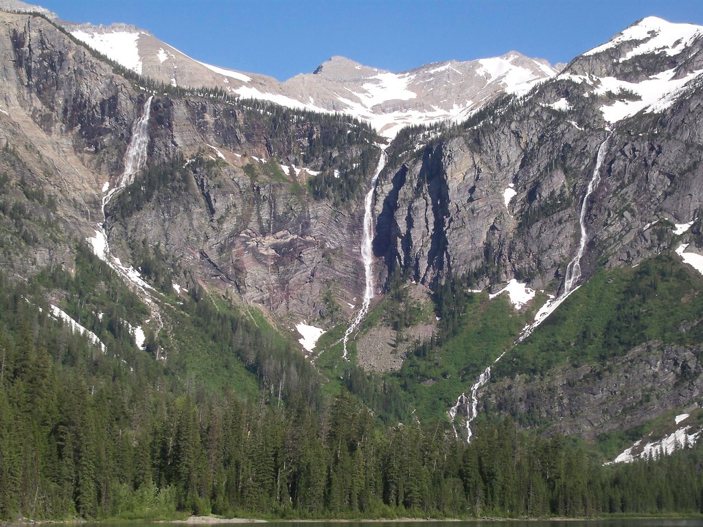 |
| Falls above Avalanche Lake |
Tuesday we took a shuttle back to the west gate and rode 50-some miles over Marias Pass to get to the east side of the park. More on that in the next post.
Side note: I know, all I'm saying about what we see is "It's Awesome! It's Beautiful!" Just look at the pictures on my flickr to get the true appreciation.
*For you non-Americans, Memorial Day is the last Monday of May, Labor day the first Monday of September. (We Americans like Monday holidays.) For most intents and purposes this defines "summer" in the US, especially when it relates to seasonal operations.


Beautiful Vista's!
ReplyDeletePedal, Shawn! Pedal with all your might!
ReplyDelete