
 |
| A bucolic scene of the Columbia Slough |
There are other good reasons for taking a bike ride: it was nice out. Brilliantly sunny, cloudless sky, high of 74F (23C). It's the highest temp I've seen since we returned to Portland. We most likely won't see such warm weather until March. Let me take advantage of it while I can. And April has come down with a cold, meaning I will probably too. I should get out before I have to be in bed for a day.
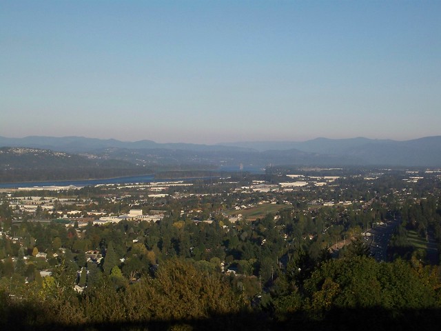
The initial plan for the bicycle ride is what I consider my "classic": ride out to the Columbia Gorge. It would be a 30-50 mile ride depending on how far I would go. And I would get views such as this:

But unfortunately riding to the Gorge was not to be, for two reasons. I didn't wake up early enough to pull it off. Blame that on not being smart enough to set my alarm. But the bigger reason was the wind. It was blowing 10-15 mph out of the east in town. The Gorge is a "wind tunnel", so if the wind is that bad in town, it will be double the strength out there. There is a reason why Hood River, nestled in the Gorge, is the "wind surfing capitol of the world." I battled enough headwinds on tour when I had no choice, so why fight it when I don't have to?
So the idea formulated itself. Ride eastward then turn around. Yes, I'd have a headwind one-way, but an awesome tail-wind the other. My vague idea was to head east along the Springwater Corridor, a bike path I have taken so many times before. No new territory to be explored here; the ride would reacquaint myself with my surroundings.
The scenery on the Springwater for the most part is okay. Since it's a rail-trail, a lot of it passes by still-active industrial areas, overgrown nooks where one can drink all day without harassment, and occasional dumpy houses. This is Portland's forgotten backside. But it doesn't take that long to get out of this zone and get into areas with a more rural feel. And that's what I wanted. For example, when the Corridor passes the south side of Powell Butte* I paused by this small sheep farm:
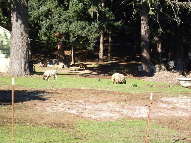
I looked at my cyclometer. I had barely pedaled 7 miles from my house in inner SE, a neighborhood about 3 miles from downtown. 10 miles from downtown Portland, a city pushing 600,000, and a sheep farm. For comparison, when we visited Chicago last month, we stayed in the Rogers Park neighborhood, about 10 miles from downtown. Rogers Park is on the edge of Chicago, and is still a thoroughly urban neighborhood. Powell Butte is on the edge of Portland, but still within city limits. There were no sheep farms in Rogers Park.
And this is one reason why after travelling around the U.S. and Canada quite extensively over the past decade, I still return to Portland. No, it's not about the sheep farm per se, but what the sheep farm means. Portland is as urban as I want it to be with all the bells and whistles.** But it is so close to rural areas and actual wilderness. An hour of biking brought me to a sheep farm on the side of an extinct volcano, with a view of a dormant volcano in the distance. Another hour and a half of riding would bring me to that view of the Columbia Gorge shown above. Ride all day and I would reach the base of that dormant volcano in the distance.
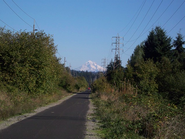
I needed to see these things. I've been back in town for nearly two weeks, gotten reacquainted with old friends and stuff that I do that is within the urban core. But it still feels so weird. Am I really back? Why am I back? Sometimes I feel like my extended trips are an opportunity to find another town to live in. Well, it's not like I'm actively looking for to move, but maybe more so a taste test of new flavors. Can I live in this town? Many places I can imagine living in for a short time, tolerating it for a year or two if circumstances dictated. A few towns I could see being happy in for an indefinite period of time, like Vancouver and Minneapolis.*** But could I leave Portland? Rides like this remind me why I live in the Rose City. Yeah, I had to ride through some dumpy areas (and will ride through some more), but every town has their dumpy side. The positives are what matter. And positives like the view of Mount Hood that greets me on the trail around this point:
I pedaled a few more miles into the city of Gresham and came to the junction of the Gresham-Fairview Trail, which is where I turned north.
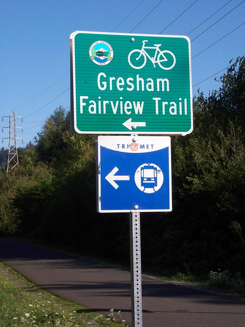
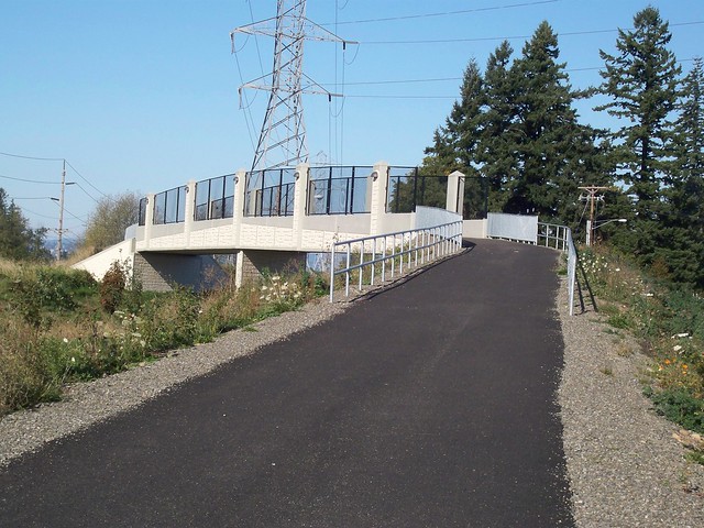
The Gresham-Fairview Trail also follows an abandoned rail line (one that connected to the Springwater line), but the trail itself has only been built over the last few years. The connection to the Springwater was only completed late last year. It uses this spangly new bridge to cross over ultra-busy Powell Blvd.
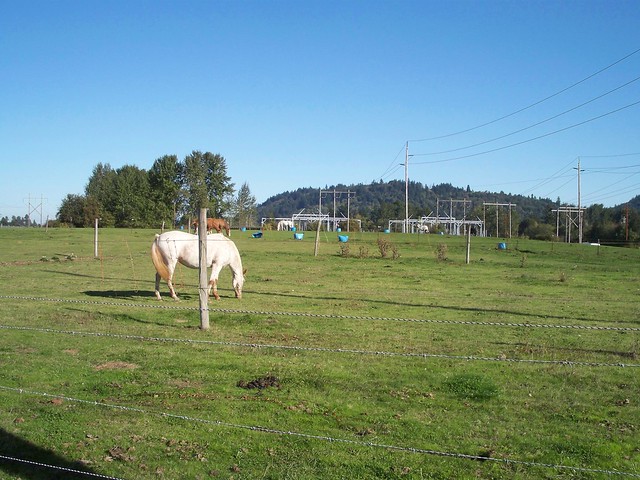
Right before the bridge was a...horse farm.
And from the bridge, a great view of the not-so-dormant Mt. St. Helens.

I rode the Gresham-Fairview north until I hit Marine Drive**** which follows the Columbia River. I forgot to mention how fierce the headwind had been the further east I had gone, but now since I was heading due west on flat and straight Marine Drive, I was cruising at 20 mph with little effort.
I used Marine until I hit the I-205 Bike Path and headed south towards the jewel of the ride, Rocky Butte.
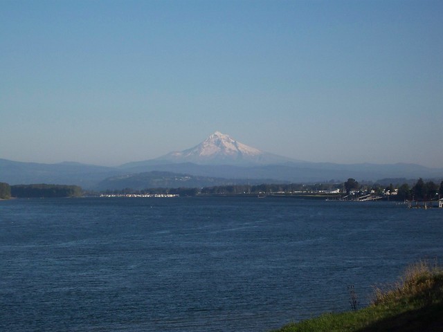 |
| Mt. Hood over the Columbia, from Marine Drive |
I used Marine until I hit the I-205 Bike Path and headed south towards the jewel of the ride, Rocky Butte.

Rocky Butte, like its cousins Powell Butte and the well-known Mount Tabor, is a extinct volcanic cone. It's not that high, only 600 ft (180 m) at its top, but it has prominence over the flattish, near sea-level landscape that surrounds it. The ride up is a little bit of an ass-kicker (roadies love it) as the sides are fairly steep. But somehow this time up it didn't feel as bad as it has been in the past. Maybe all those countless miles of grinding up mountain passes with a fully loaded bike have conditioned me? Maybe one mile at about a 6% grade ain't no thing after all? Anyways...
At the top is Joseph Wood Hill Park. The road up to the top (Rocky Butte Drive, formerly Academy Drive) and the fortified park at the top were built by the WPA during the 1930's. The drive features stone retaining walls reminiscent of the Historic Columbia River Highway, using stone quarried from the butte itself. The walls on the fort-park also feature this beautiful stone. And to think it was all built by hand.
 |
| Yes, built by hand. The wall, that is. |
 |
| Outtakes from the Houses of the Holy cover shoot. |
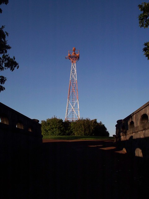
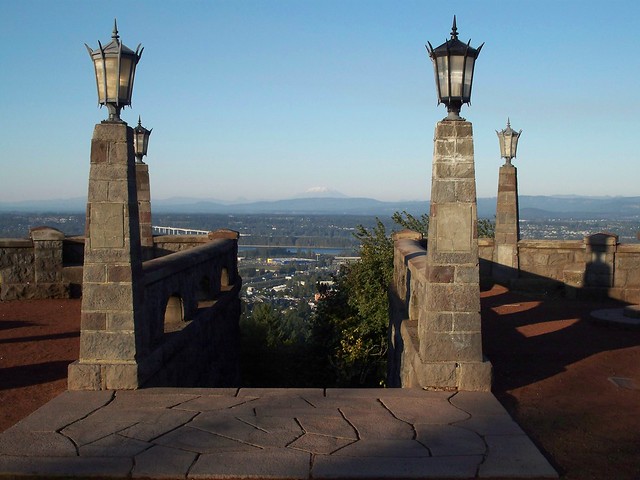
The built environment (including the decommissioned airway beacon, while not being used for its originally intended purpose, still shins every night) is beautiful enough. But the main selling feature of the park is the view. We get an almost 360-degree view of the surroundings, everything from the West Hills to the west of town to the Cascades to the north and east. This is my favorite Portland view. While viewpoints like Council Crest and Pittock Mansion in the West Hills are higher, they don't offer the same panorama as Rocky Butte. From Rocky Butte I can see pretty much everything that makes this place special, everything that keeps me here. Seemingly endless urban neighborhoods mingled with natural splendor. Trees and hills and mountains and water. Two hours by car in any compass direction brings me either to ocean, desert, more trees and mountains, or other cities. How can I not love it?
I spent about twenty minutes on top. The sun was about to go down, so I bombed down the north side of the Butte (going through the famed tunnel) and headed through various neighborhoods on the way home. It feels good to be back.
 |
| Framing Mt. St. Helens |
 |
| The entrance to the Columbia Gorge in the hazy distance |
I spent about twenty minutes on top. The sun was about to go down, so I bombed down the north side of the Butte (going through the famed tunnel) and headed through various neighborhoods on the way home. It feels good to be back.
*one of the area's numerous extinct volcanic cones
**Though I wouldn't mind a better art museum.
***If I could hack the winters.
****Okay, it's not a straight shot between the two, but I don't want to bore you with the "The trail dumped me onto NE 201st, which I followed north, then I turned west onto the I-84 Path, then north on 181st, which bends west into Airport Way, then north on 158th" business.
hey, you went right past me! i live near the sheep farm and one of my favorite views of mt. hood is when it's framed by the springwater corridor trail.
ReplyDeletewelcome back to pdx!
That's a great trail that points to Mt. Hood!
ReplyDelete