
 |
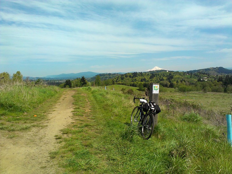
| Atop Powell Butte. Mt. Hood in the distance. |
I had Thursday April 25 off. I had the day off, but had a meeting with Ed and Stasia at 5:30 pm. I wanted to get a ride in. But where? Powell Butte seemed like an obvious choice: far enough away to see how the XO-3 handled distance riding, challenging enough (on the Butte) to see how it handled dirt and climbing. Plus, Powell Butte is one of those places I should go to more often but don't. The last time I went was in October, on the last "fun" ride that I did with the short lived Raleigh M40 mountain bike.* A trip back there was long overdue.
 |
| Springwater Corridor near Powell Butte. |
I cut through the neighborhoods of SE just south of my apartment and got onto the Springwater Corridor trail. About a hour or so after departing the house (with a stop for lunch) I reached the entrance to Powell Butte Nature Park.

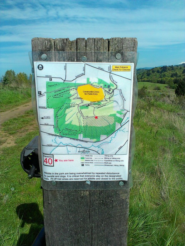
It hadn't rained in days and with the warm weather (Thursday topped out at 76F/24C) I knew that the trails were good for riding. Powell Butte has a mix of different trails around it, and much (but not all) of them are open to bicycles. (Compare this to Forest Park where only a handful of trails are open to bikes, much to the local mountain bike community's chagrin.) My usual route to the top is using the Old Orchard Trail, which is pretty steep in places. The trail is also a bit rough, with rocks and roots. While the XO-3 doesn't have particularly low gearing (50-40-30 chainring, 13-28 seven speed cassette), it did okay with the climbing.
 |
| Climbing Old Orchard. |
After the short ride to the top, the forested landscape opened up to a large meadow. From here I had a choice view of the lands of "East County" and also saw four of the five snow covered volcanoes one can see from Portland.** It really is a great view, especially since we don't get many "open expanses of meadow on a hilltop" in these parts. Over the years I've watched a couple sunrises from this prospect on Summer Solstice, always a great time. I spent about a half-hour at the top before I hit the trails to get back to the bottom.
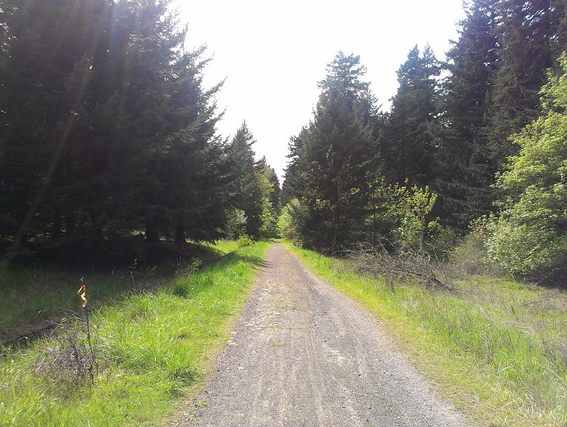 |
| This service road is "not a trail", folks. |
But this time I explored the trails on the west side of the butte. The last time I was up here I got up to the top pretty late in the day so I was more concerned with getting down before dark than anything else. This time because I had to be somewhere well before sundown, I didn't have that concern. (I guess that is the advantage of having a deadline.) And man, there are some cool trails on the west side of the butte! I rode out first on a service road (which very much advertised that it was "Not A Trail") which connected to the Elderberry Trail. This trail was very much designed for mountain bikes, with a very twisty switchback section at one point. But unlike the Old Orchard, it was much better graded, no rocks or roots that I saw. This trail winded its way along the hillside and then finally dumped me near the Springwater Corridor entrance, the point where I entered the park about an hour and a half earlier.
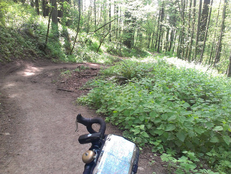 |
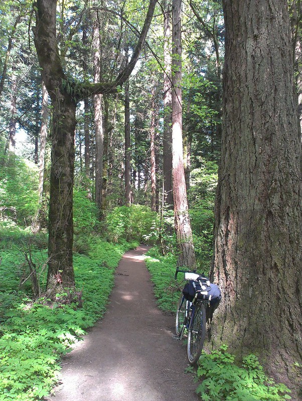
| The windy section of the Elderberry Trail. |
From there, I headed back into "town" on mostly neighborhood streets and got to the meeting spot at 30th and SE Belmont with time to spare. Overall the ride was a bit shy of 30 miles.
So how did the XO-3 do? Overall, good. It would be nice to have a bit lower gearing, but the tires (Panaracer Pasela Tourguards 700x35C) were up to task and the bike itself handled well, on and off road. The handlebars are not ideal for long distances, though, but that's going to change soon enough.
And this is by no means the end of rough stuff for the XO-3...
For more photos, go here.
*I haven't gone up there with the Raleigh Crested Butte yet, so that means I need to soon!
**The four are Hood, St. Helens, Adams, and Jefferson. Rainier is visible if you are far enough west but from this vantage it's obscured by St. Helens.
Nice! And extra points for some trail riding (we've been doing a bit of that here lately as well,the Boy and myself :D ) :)
ReplyDeleteSS
Those trails look like something I could handle, even on my girly bike.
ReplyDeleteHa! I'm not sure how to feel about this! First I was thinking, "man, I sure wish we'd opted to meet another day so you didn't have to curtail your bike ride," but then I got to the "advantage of having a deadline part" and now I don't know what to think! heh. Thanks for coming out to meet us, even though it meant perhaps less exploring:) Looks like a sweet ride.
ReplyDeleteGood ride report. I enjoy reading about the rides people have been getting to. I have been getting out for some road rides but with the sudden rash of repeating snow storms the off pavement road and trail rides are going to be a bit longer to open up.
ReplyDeleteLooks like you had much of the park to yourself. Nice ride!
Jim