THIS BLOG IS DEAD.

NOTE 23 January 2014: New posts are no longer posted to this blog. New stuff at my new blog, http://urbanadventureleague.wordpress.com/ Please go there! All old and new posts are there, and you can also comment, too!
Showing posts with label hood-adams-helens tour 2012. Show all posts

Thursday, December 27, 2012

2012 Bike Camping and Touring Relfections

After being on the road for four and a half-months on the Cross-Continent Bike Tour in 2011, it would be really hard for 2012 to measure up. Still, 2012 shaped up to be a pretty decent year bicycle wise.

April and I started the bike camping/touring year right on New Years with our annual tradition of hitting up the cabins at Stub Stewart State Park with a bunch of friends. February saw the next (and final if you don't count the cabin camping we'll do at the end of this year) cabin camping trip to Battle Ground Lake.

Tent/bivy camping started with the Cycle Wild trip to Ainsworth in April. Emboldened by weekends of good weather and the itch to go bike camping again, the following two weekends saw camping expeditions to two new (for me) campgrounds: Sunset on the edge of Gifford Pinchot National Forest and Paradise Point State Park in Washington.

For a brief moment, I hoped to keep up that clip of a bike camping trip every week or every other week, but weather and life conspired against me. Still, May was good with two trips: Milo McIver and the Champoeg/Silver Falls excursion over Memorial Day.

Then soon after that was my first bike tour of the year: the nine day PDX-Oly-Astoria jaunt right at the beginning of June. The rest of June was busy with Pedalpalooza, but I still got in a mid-week camping expedition to Battle Ground again. (This was part of the Pedalpalooza calendar.) After Pedalpalooza was my first attempt at bush camping in the Portland metro area: the comical trip to Sauvie Island.

While July was prime bicycling and sleeping outdoors weather, I only managed a "small" tour: the Hood-Adams-Helens five day bivouac. August saw my third and final trip to Battle Ground (a Cycle Wild event) on possibly the hottest weekend of the year. I finished off August with my longest and most epic tour of 2012: the ten day Helens-Rainier-Seattle-Vashon trip.

September saw a "bike-augmented camping" trip to Cape Disappointment right after Labor Day, and a mid-week overnight to Metzler Park in Clackamas County. While the weather was still good for another month and I had all intentions of doing more camping, Metzler was the last camping trip of the year.

Though I didn't think it was that impressive at the time, looking back at the year I had a good run:
  • Eight bike overnights
  • Three three-day trips (Stub cabins, Champoeg/Silver Falls, Cape Disappointment)
  • Three tours
All added together, this totals 49 nights away, over a month and a half of bike adventure overall.
Moosemoose saw some action, no doubt.

While I obviously went to many places I've been before over roads I've ridden many a time, this year I hit up a lot of new territory, like Sunset, Paradise Point, and Metzler in the overnight categories and biking around the Cascades and over the Willapa Hills in the touring categories. Even on tours through areas I've been through multiple times, like between Portland and Olympia, I managed to find new-to-me roads.

One theme of travel over the past year becomes apparent when you put it all together: I stayed close to home in 2012. At no point was I more than 200 miles from Portland. This was by design. I wanted to explore new areas that were nearby, and most importantly I was very, very broke in 2012. For the first eight months of the year, the months I did the majority of my camping/touring, I did not have a regular job. I couldn't afford big train trips or expensive overnight accommodations. 

I must say that I'm pretty satisfied with what I accomplished. I biked over mountains and to the coast. I hung out in Olympia and Seattle. I saw a bear again and met German bike tourists.

Still, there were two places in 2012 I would have liked to tour that I didn't get to: around Crater Lake and the Cascades in southern Oregon and the many island archipelagos (San Juans, Gulf) in the "inland sea" of the Northwest. No biggie, as they ain't far away. And there's always 2013...

Sunday, September 23, 2012

Thoughts on my 2012 tours: Hood-Adams-Helens, July

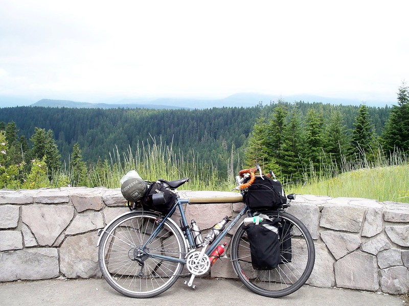
LHT and McGee Creek, Lolo Pass Road, Mt. Hood National Forest
Ah, what a weird beast of a tour this was! Not too long, not too short. (5 days) The first two days were really short. The first day was a group ride with Cycle Wild, the second day was just with April, the last three I went solo.

The big thing about this ride was climbs. The PDX-Oly-Astoria Tour in June got me back in the swing of touring again, but it was climbless. Yes, there were hills, a few short steep ones too. Yes, I "summited" the Coast Range, but it was only 700 feet and the climb was so gradual. I hadn't done a true mountain climb since July of 2011, while on tour through the Canadian Rockies. A year without a mountain pass, and I was feeling rusty. What I needed was an honest to goodness mountain pass. Or two.

And the Hood-Adams-Helens tour delivered. While neither of the passes, Lolo at 3,450 feet and Oldman at 3,000 feet, would be considered big mountain passes (at least not in this part of the west), they were climbs. Both were steep, Oldman more so, but by the time I got to Oldman I was ready for it.* No need to worry about my mountain-climbing ability, I can still do it.
Mt. Hood and Hood River valley from Lost Lake Road

The best part of the trip was riding along the quiet roads through the National Forests. Both Lolo Pass Road and Wind River Road had minimal amounts of traffic, and lots of scenery. Sure, there was gravel here and clearcuts there, but overall it was good. Good enough for me to want to tackle more Forest Service roads in August.

The second-best part of the trip was the century I pulled on Day 5, the final day. While planning the trip, I had no intentions of doing it, so I set up a place to stay around the 75 mile mark. But as I closed in on that mark, I said, why stop? Home is so close. So I kept on going. Yes, it was dark when I got into Portland, but it ain't like it was the first time I rode in Portland after dark! I've done centuries before, but it's always nice to know I still have it in me. Bragging rights, if you will. And unlike most folk who ride 100 or more miles at one clip, I've always done mine with a full touring load. (Bragging rights, indeed!)


*Not so much in August on the Helens-Rainier-Seattle-Vashon tour, where Oldman was the first climb of the trip.

Sunday, July 22, 2012

Hood-Adams-Helens Tour: The Photos!

In case you haven't noticed it, I uploaded photos from my recent Hood-Adams-Helens tour to my flickr account. Go check them out!

Tuesday, July 17, 2012

Hood-Adams-Helens Tour, Day 5: Sat 14 July, the unexpected century

Oh Mount St. Helens, please do not blow up on me.
And a fine Bastille Day it was! When I planned this tour, I knew the fifth and last day would be a long one. I just didn't realize how long it would be.

I left Paradise Creek Campground a little after 10 am. (The other cyclists had already left by the time I woke up at 7:45am, which I figured since they had already retired by 7:30pm.) The first five miles of the day were the toughest, a 6-8% climb up to Oldman Pass with an elevation gain of around 1,500 feet. The morning was peaceful (if a little damp) and quiet, as there wasn't much traffic on Wind River Road. The scenery was fine if not spectacular, basically a climb through the woods.

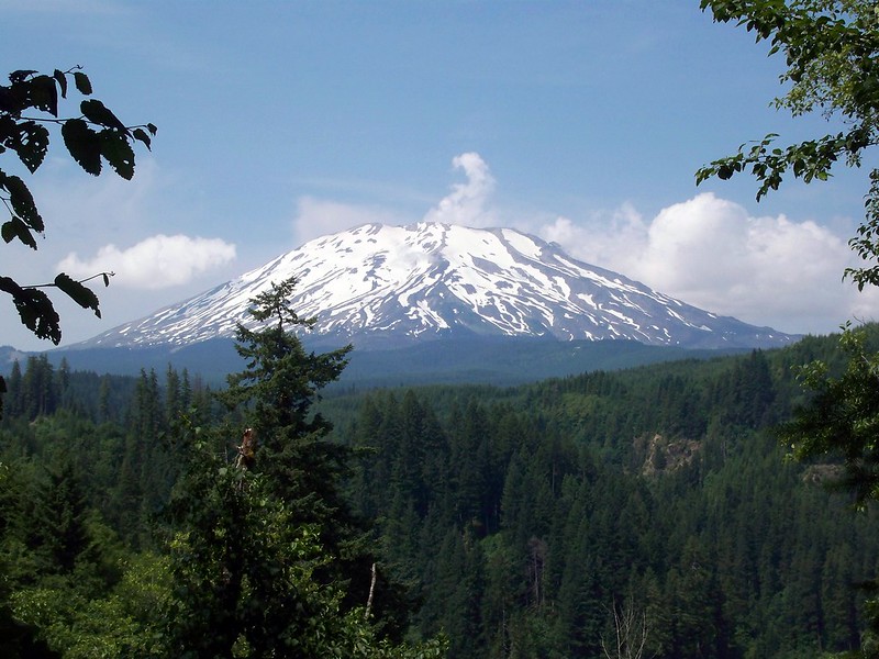
An hour later I finally got Oldman Pass (3,000 feet), though there was no great view from the top. The "view" would come in a few more miles on the descent down Curly Creek Road. And the reason why view is in quotations is because low cloud cover obscured Mount St. Helens at McClellan viewpoint, so it wasn't as good as it could have been. Of course, the cloud cover waited to burn off right as I left. But then I got to see St. Helens on the screaming and beautiful (and screamingly beautiful) descent down. It was one of those descents that didn't feel as fast as others...until I looked down at my speedometer and noticed I topped out at 42 miles and hour (68 km/hr). Yikes! That's possibly the fastest I've ever gone on a bike!
McClellan viewpoint

Once I got to the bottom of the descent it was about 20 miles of riding on the north shore of Swift Reservoir, an impoundment of the Lewis River. The road was windy and up and down, but thankfully no big grades and little traffic. Still, this section was the least thrilling part of the ride, as there wasn't much of a view for most of it, and when there was, it was a man-made lake. (I can't get that excited about man-made lakes.) After almost 40 miles, I was in the "blink and you'll miss it" town of Cougar, on the edge of the Gifford Pinchot National Forest. I stopped to have some lunch and ponder what to do next.

I had lined up a Warmshowers host in Brush Prairie, a "town" outside Battle Ground. It would still be another 30 miles to get there. As I said earlier, I had already planned on a long day for today. The only camping options (besides Battle Ground Lake, which would be near Brush Prairie) would be some Pacific Power campsites along the many lakes on the Lewis River. April and I had been to them before, and found them crowded, expensive, and lacking in charm. So that's why I had planned on a long day.

But why just go to Brush Prairie? From there, it would be about 20 miles to the Red Line MAX. I could get home tonight. Yeah, it would mean a ninety mile day, but so what? At least I would get home. And not have to interact with strangers. Not that I have anything wrong with Warmshowers, it's just that after a long day of riding sometimes I don't feel like interacting with people I don't know. So I decided to push on, all the way home.
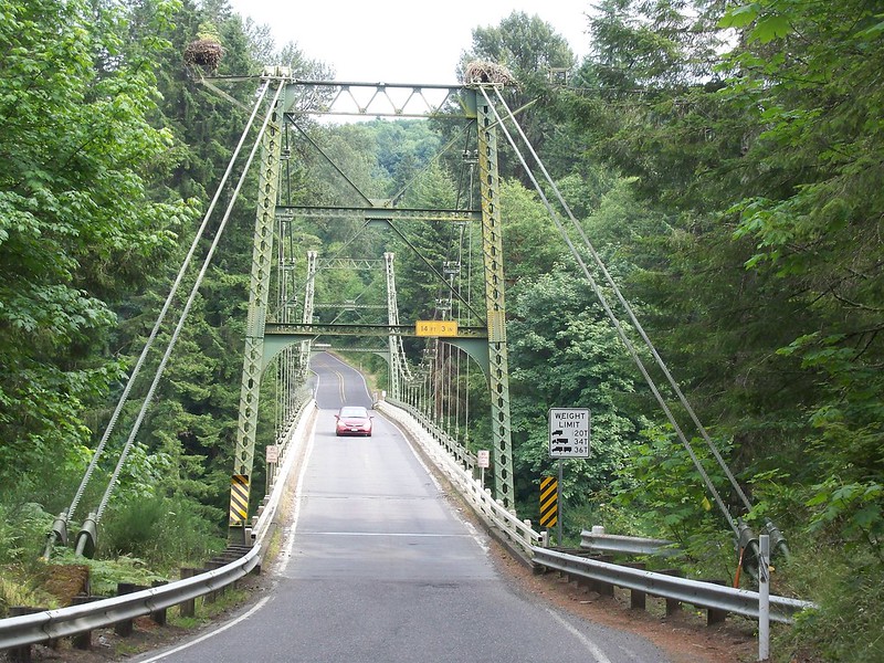
Yale Bridge, Lewis River
The rest of the ride was through charted territory, as April and I had ridden out this way in 2010 during our St. Helens mini-tour. I just pushed on. The scenery improved as I reached the rural eastern reaches of Clark County and I made it to the Glenn Jackson (I-205) Bridge just after nightfall. The plan was to hop on the MAX at Cascades Station (by the IKEA) as it was 10pm and I was tired. Despite all that, I got a wild hair up my ass and pondered riding the whole way home, as it would put me near 100 miles for the day. But why? I was tired, and have already pulled a century a few times. What am I trying to prove? Just get on the MAX.

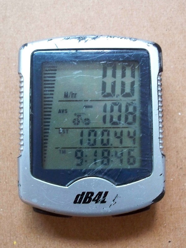
Of course, a minute away from the MAX station I saw the train depart. Knowing that at this time of night it may be at least a half-hour until the next train, I decided to just ride. And ride I did. A few blocks away from home, the tripometer on my cycle computer passed the hundred mile mark. And then I was home. Exhausted, I wolfed down my food and snuggled April. The tour was over.

Saturday, July 14, 2012

Hood-Adams-Helens Tour, Day 4: Fri 13 July

Windsurfers at Hood River
Even though I woke up relatively early, I still left the home of my Warmshowers host after 10 am. Ah, slowpoke I am. I rode down the steep hill into downtown Hood River, a town I always enjoy visiting but don't get to often. (I think the last time I was here was 2009.) Of course, as soon as I got into town I felt like spending a good part of the day here. But if I hope to make it to a USFS campground up the Wind River by nightfall, I need to get a move on. It was tempting to get beer and food at Double Mountain Brewery but to do so would have meant waiting over a half hour for it to open. Alas.

The twenty miles west from Hood River to Cascade Locks was tough, to say the least. The wind during the summer blows from the west in the Columbia Gorge, and it blows fiercely. (There is a reason why Hood River is the windsurfing capitol of the universe.) I was looking at a consistent 15 to 25 mile an hour headwind. And it didn't help that I had to ride on the shoulder of Interstate 84 for most of it. At least it was scenic...

And by heading west on I-84 I saw a hidden abandoned section of the old Columbia River Highway just east of Hood River. The old stone railings were very intact. Wonder how many cars whizz by it each day without ever knowing it was there!

Oh yeah, I managed to see some other tourons on the way to Cascade Locks. Of course, they were on the other side of the freeway, going the other way. So no conversations, alas.

I ate some mediocre lunch in Cascade Locks, crossed the Bridge of the Gods, and then headed eastward into Stevenson, Washington. Now I had a tailwind! I drank some beer (Walking Man), got some more supplies, and then headed further east to the turnoff on Wind River Road in Carson. While the road paralleled the river, it was out of sight for the first 10 or so miles. The road kept on climbing gradually the whole way, and after some ho-hum territory near Carson, the scenery improved. I was in the Gifford Pinchot National Forest. I was in the woods again. It was awesome.

On the way up I ran into my friends Scott and Ashley heading down the road. They were on Gabe's Gorge gravel ride, a tour I could have gone on, but found all the climbing and gravel on the proposed route too intense for my taste. And now Scott and Ashley felt the same way, as they were taking a flatter, paved shortcut.

It was about 7:30 when I pulled into Paradise Creek campground. The campground is about five miles from Oldman Pass, and I wanted to camp as close to the pass as possible to make Saturday as easy as possible. The campground was pleasant enough, but almost full and filled with a lot of families, as it is a weekend in July. I spotted two other bike campers and wanted to go talk to them (and also see if they would be into splitting a campsite) but apparently they were already asleep. Alas.

Saturday promises to be a long day, but hopefully not as tough as Friday.

53.9 miles
9.5 average speed
5:40 saddle time

Friday, July 13, 2012

Hood-Adams-Helens Tour, Day 3: Thurs 12 July

Mt. Hood looms over the Sandy River valley
April and I made a breakfast of pancakes and coffee at Green Canyon campground and then head the 5 miles down the road to the junction of US 26 to the Zig Zag Ranger Station. April had to head back to town, so we bid goodbyes and I was on my own.

The next 11 miles were on Lolo Pass Road, ascending to the pass. The first four miles was a moderate grade, and the last seven was a pretty serious grade, about 8%. While the grade was steep, I just got into the low gear and kept going. The road gave me great panoramic views of Mount Hood and the Sandy River valley. Of course, the reason I was getting these great views was because of all the open land needed for the giant high tension power lines overhead. Ah, well.
Lolo Pass in the distance
After much sweating (which was alleviated by dunking my hat and jersey in a cold creek) I reached Lolo Pass (elevation 3,400 feet) around 2:30. The next 5 1/2 miles of descent was on gravel. I'm not a fan of gravel, but this section wasn't that bad. After this, the road became paved again, but only one lane wide. I didn't see any traffic on this section. At times I felt like I was on the best road in the world--the scenery breathtaking, the weather perfect, and I didn't have to share the road with any other vehicles. Then I would pass through a clearcut. Ah, national forests.

After winding through the national forest for hours I re-entered "the real world", which meant traffic. OR 281 had a good deal of traffic as I entered Hood River. I'm guessing it had something to do with "rush hour". I reached my Warmshowers host around 6 pm. After a big dinner, I relaxed for the rest of the night.

48.6 miles
9.7 average speed
5:00 saddle time

Thursday, July 12, 2012

Hood-Adams-Helens Tour, Days 1 and 2: Tues 10 and Wed 11 July

A funny thing happened on the way out to the MAX station before the ride...

I noticed a weird squeaking noise under my saddle during the ride. At first I wrote it off as spring noise (my LHT has a sprung Brooks Champion Flyer) as it has made it before. But this time it sounded...different. And just before the Hollywood MAX station my saddle came undone. This is when I realized that the bolt holding saddle clamp to seat post had broken into two. Oops. Not a common thing to break, but also something that happened to me before.

Oh well. At least it happened in town, not on the side of the road on the climb to Lolo Pass. I ran over to Velo Cult, but they didn't have a replacement bolt. So off to the hardware store where they did have one.

All in all this business delayed us by 45 minutes, meaning I was late to the ride I was supposed to lead. Nevertheless, Matt P. got any folks who were meeting at the MAX stop, so after getting off the MAX ourselves we met the group of five at the Fred Meyer in Gresham.

The 12 miles of riding from Freddies to Dodge park were mostly good. Nice scenic and pleasant riding with gentle uphills and a nice drop down to the Sandy River. But notice I said mostly. Some punk ass kids in a burgundy Pontiac Bonneville decided to throw an empty box of Voodoo Doughnuts* and a bottle of water at us. WTF? It's been a long time since I've had shit thrown at us from a car. Not fun.

We made it to Dodge Park before dark (for a change.) This new campground owned by the Portland Water Bureau was pretty empty so the crew took up two spots. Dodge Park itself was pretty nice with walks along both the Sandy and Bull Run Rivers. We hung out around the fire until we were all done.

In the morning the rest of the group went back in drips and drabs while April and I lingered a bit and then headed eastward towards Mount Hood. We had quite a bit of climbing for about the first 8 miles, as we climbed up over the ridge between the Sandy and Bull Run valleys known as The Devil's Backbone. It was worth it, as the traffic was virtually non-existent and we either travelled under a canopy of trees or had expansive views. After 15 miles we turned onto US 26. We were very hungry and hot when we got to Welches, where we both wolfed down wraps, bought a shit-ton of local berries, and got other supplies at a grocery store.

From there it was a quiet 5 miles of riding on Forest Service road along the Salmon River into Mount Hood National Forest, where we set up camp at Green Canyon campground. Wednesday night's camping experience was much more wild than Tuesday's at Dodge Park. It doesn't hurt that we were surrounded by actual wilderness, as the road and campground are literally surrounded by the federally protected Salmon-Huckleberry Wilderness. And we fell asleep to the sound of a rushing river...

Day 1, Tues 7/10/12: Cleveland Ave. MAX, Gresham to Dodge Park near Sandy
13.8 miles
11.2 avg. speed
1:14 saddle time

Day 2, Wed 7/11/12: to Green Canyon campground, Mt. Hood National Forest
24.8 miles
9.6 avg. speed
2:36 saddle time

*If I didn't know any better I would think it was a clever way for Tres Shannon and "Cat Daddy" to market their wares.